
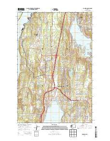
~ Poulsbo WA topo map, 1:24000 scale, 7.5 X 7.5 Minute, Current, 2014
Poulsbo, Washington, USGS topographic map dated 2014.
Includes geographic coordinates (latitude and longitude). This topographic map is suitable for hiking, camping, and exploring, or framing it as a wall map.
Printed on-demand using high resolution imagery, on heavy weight and acid free paper, or alternatively on a variety of synthetic materials.
Topos available on paper, Waterproof, Poly, or Tyvek. Usually shipping rolled, unless combined with other folded maps in one order.
- Product Number: USGS-7532517
- Free digital map download (high-resolution, GeoPDF): Poulsbo, Washington (file size: 30 MB)
- Map Size: please refer to the dimensions of the GeoPDF map above
- Weight (paper map): ca. 55 grams
- Map Type: POD USGS Topographic Map
- Map Series: US Topo
- Map Verison: Current
- Cell ID: 36228
- Datum: North American Datum of 1983
- Map Projection: Transverse Mercator
- Map Cell Name: Poulsbo
- Grid size: 7.5 X 7.5 Minute
- Date on map: 2014
- Map Scale: 1:24000
- Geographical region: Washington, United States
Neighboring Maps:
All neighboring USGS topo maps are available for sale online at a variety of scales.
Spatial coverage:
Topo map Poulsbo, Washington, covers the geographical area associated the following places:
- Madrona Ridge Mobile Home Park - Central Valley - Clear Creek Mobile Home Park - Poulsbo - Countryside Mobile Home Park - Parkwood East - Viking Mobile Home Park - Silver Creek Meadows Mobile Home Park - Golden Mobile Home Park - Whispering Firs Mobile Park - Virginia - Pearson - Olympic View - Johansons Corner - Meadowdale - Poulsbo Mobile Park - Bangor - Steele Creek Mobile Home Park - Silverdale - Seabird Mobile Home Park - Sunset Farm - Huckle Ridge - Scandia
- Map Area ID: AREA47.7547.625-122.75-122.625
- Northwest corner Lat/Long code: USGSNW47.75-122.75
- Northeast corner Lat/Long code: USGSNE47.75-122.625
- Southwest corner Lat/Long code: USGSSW47.625-122.75
- Southeast corner Lat/Long code: USGSSE47.625-122.625
- Northern map edge Latitude: 47.75
- Southern map edge Latitude: 47.625
- Western map edge Longitude: -122.75
- Eastern map edge Longitude: -122.625


