
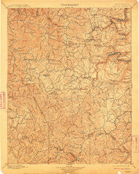
~ Raleigh WV topo map, 1:125000 scale, 30 X 30 Minute, Historical, 1902, updated 1910
Raleigh, West Virginia, USGS topographic map dated 1902.
Includes geographic coordinates (latitude and longitude). This topographic map is suitable for hiking, camping, and exploring, or framing it as a wall map.
Printed on-demand using high resolution imagery, on heavy weight and acid free paper, or alternatively on a variety of synthetic materials.
Topos available on paper, Waterproof, Poly, or Tyvek. Usually shipping rolled, unless combined with other folded maps in one order.
- Product Number: USGS-5638763
- Free digital map download (high-resolution, GeoPDF): Raleigh, West Virginia (file size: 11 MB)
- Map Size: please refer to the dimensions of the GeoPDF map above
- Weight (paper map): ca. 55 grams
- Map Type: POD USGS Topographic Map
- Map Series: HTMC
- Map Verison: Historical
- Cell ID: 395869
- Scan ID: 254010
- Imprint Year: 1910
- Survey Year: 1895
- Datum: Unstated
- Map Projection: Unstated
- Map published by United States Geological Survey
- Map Language: English
- Scanner Resolution: 600 dpi
- Map Cell Name: Raleigh
- Grid size: 30 X 30 Minute
- Date on map: 1902
- Map Scale: 1:125000
- Geographical region: West Virginia, United States
Neighboring Maps:
All neighboring USGS topo maps are available for sale online at a variety of scales.
Spatial coverage:
Topo map Raleigh, West Virginia, covers the geographical area associated the following places:
- Clear Creek - Herndon - Rock Creek - Terry Junction - Sweeneyburg - McVey - Pierpont - Basin - Lively - Arnett - Kilsyth - Corinne - Piney View - Herndon Heights - Pemberton - Derryhale - Ogden - Thayer - Newlyn - Cirtsville - Saxon - Ellison Ridge - Sullivan - Hilltop - Wyco - Sprague - East Sewell (historical) - Alpoca - Bowlin - Joe Branch - Harper - Sun - Glen Rogers - Rush Run (historical) - East Kingston - Itmann - Spangler Factory (historical) - Princewick - Flat Top - Nuriva - Coal City - Old Mill Village - Jonben - Cherry Creek - Egeria - Grandview - Iroquois - Surveyor - Terry - Winding Gulf - Elmore - Dry Creek - Export (historical) - Beury - Pax - Concho - Mead - Ephram (historical) - Blue Jay - Dimmock - Rhodell - Madeline - Shady Spring - Prosperity - Glade Springs - Johnstown - Hoohoo - Bays Heights - Crab Orchard - Maynor - Roseville (historical) - Rodes (historical) - Harper Heights - Metalton - Tams - McAlpin - Lego - Oak Hill Junction - Harvey - Pinepoca (historical) - Crow - Pennbrook (historical) - Lanark - Lick Fork - Carlisle - Wright - Odd - Turkey Knob - McKendree - Dameron - East Oak Hill - Montecarlo - Whitby - Fitzpatrick - Long Branch - Cunard - Milburn - Cedar - Salem - Streeter
- Map Area ID: AREA3837.5-81.5-81
- Northwest corner Lat/Long code: USGSNW38-81.5
- Northeast corner Lat/Long code: USGSNE38-81
- Southwest corner Lat/Long code: USGSSW37.5-81.5
- Southeast corner Lat/Long code: USGSSE37.5-81
- Northern map edge Latitude: 38
- Southern map edge Latitude: 37.5
- Western map edge Longitude: -81.5
- Eastern map edge Longitude: -81


