
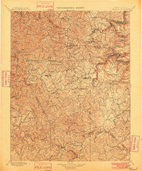
~ Raleigh WV topo map, 1:125000 scale, 30 X 30 Minute, Historical, 1902
Raleigh, West Virginia, USGS topographic map dated 1902.
Includes geographic coordinates (latitude and longitude). This topographic map is suitable for hiking, camping, and exploring, or framing it as a wall map.
Printed on-demand using high resolution imagery, on heavy weight and acid free paper, or alternatively on a variety of synthetic materials.
Topos available on paper, Waterproof, Poly, or Tyvek. Usually shipping rolled, unless combined with other folded maps in one order.
- Product Number: USGS-5638759
- Free digital map download (high-resolution, GeoPDF): Raleigh, West Virginia (file size: 13 MB)
- Map Size: please refer to the dimensions of the GeoPDF map above
- Weight (paper map): ca. 55 grams
- Map Type: POD USGS Topographic Map
- Map Series: HTMC
- Map Verison: Historical
- Cell ID: 395869
- Scan ID: 254008
- Survey Year: 1895
- Datum: Unstated
- Map Projection: Unstated
- Map published by United States Geological Survey
- Map Language: English
- Scanner Resolution: 600 dpi
- Map Cell Name: Raleigh
- Grid size: 30 X 30 Minute
- Date on map: 1902
- Map Scale: 1:125000
- Geographical region: West Virginia, United States
Neighboring Maps:
All neighboring USGS topo maps are available for sale online at a variety of scales.
Spatial coverage:
Topo map Raleigh, West Virginia, covers the geographical area associated the following places:
- Maynor - Dorothy - Jonben - Surveyor - Madeline - Coal City - Baylor (historical) - Glen Rogers - Ellison Ridge - Wyco - Quinnimont - Riley - Shiloh - Princewick - Lanark - Cranberry - Cedar - Beechwood - Emerson - Morgan Hills - Bays Heights - Whipple Junction - Glen Jean - Prudence - Pierpont - Rosedale - Fitzpatrick - Stotesbury - Cirtsville - Iroquois - Sullivan - East Kingston - Willibet - Streeter - Meadow Fork - Oswald (historical) - Dry Hill - Josephine - Ravencliff - Hamlet (historical) - Pennbrook (historical) - Crab Orchard - Big Stick - Thurmond - Willis Branch - Pax - Colcord - Fire Creek (historical) - Blue Jay 6 - Rush Run (historical) - Wright - Saxon - Take In Hollow - Dameron - Skelton - Sophia - McCreery - Killarney - Royal - Blue Jay - Matville - Montecarlo - Harper Heights - Salem - Sun - Spangler Factory (historical) - Affinity - Concho - Old Mill Village - James Crest Farms - Pineknob - Hilltop - East Beckley - Mount Tabor - Woodpeck - Egeria - Mountview - Erskine (historical) - Whorley (historical) - Ephram (historical) - Minden - Tralee - Stephenson - Stover - Warden - Maben - Turkey Knob - Rhodell - Eccles - Johnstown - Tolleys - McVey - Shady Spring - Nuriva - Macdonald - United - Sewell - Tilden - East Sewell (historical) - Roseville (historical)
- Map Area ID: AREA3837.5-81.5-81
- Northwest corner Lat/Long code: USGSNW38-81.5
- Northeast corner Lat/Long code: USGSNE38-81
- Southwest corner Lat/Long code: USGSSW37.5-81.5
- Southeast corner Lat/Long code: USGSSE37.5-81
- Northern map edge Latitude: 38
- Southern map edge Latitude: 37.5
- Western map edge Longitude: -81.5
- Eastern map edge Longitude: -81


