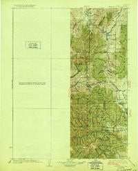
~ Ft Douglas UT topo map, 1:125000 scale, 30 X 30 Minute, Historical, 1928
Ft Douglas, Utah, USGS topographic map dated 1928.
Includes geographic coordinates (latitude and longitude). This topographic map is suitable for hiking, camping, and exploring, or framing it as a wall map.
Printed on-demand using high resolution imagery, on heavy weight and acid free paper, or alternatively on a variety of synthetic materials.
Topos available on paper, Waterproof, Poly, or Tyvek. Usually shipping rolled, unless combined with other folded maps in one order.
- Product Number: USGS-5463263
- Free digital map download (high-resolution, GeoPDF): Ft Douglas, Utah (file size: 8 MB)
- Map Size: please refer to the dimensions of the GeoPDF map above
- Weight (paper map): ca. 55 grams
- Map Type: POD USGS Topographic Map
- Map Series: HTMC
- Map Verison: Historical
- Cell ID: 65500
- Scan ID: 249450
- Woodland Tint: Yes
- Survey Year: 1925
- Datum: NAD
- Map Projection: Polyconic
- Map published by United States Geological Survey
- Map Language: English
- Scanner Resolution: 600 dpi
- Map Cell Name: Fort Douglas
- Grid size: 30 X 30 Minute
- Date on map: 1928
- Map Scale: 1:125000
- Geographical region: Utah, United States
Neighboring Maps:
All neighboring USGS topo maps are available for sale online at a variety of scales.
Spatial coverage:
Topo map Ft Douglas, Utah, covers the geographical area associated the following places:
- Governors Square Condominium - Royal Lane - Bradford Ranchos - Vista Ventes - Rothmoor Estates - Robinson Square - Western Pacific Addition - Happy Acres - Killyons - Kinney and Gourlays Improved City Plat - Grandview Estates - New Castle - Crestview Estates - Bonneville Terrace - Pedersen - Utahna Murray - Normikemark Estates - Western Acres - Southwood Manor - Pioneer Addition - Stonebridge Condo - Burkhart Estates - Oakridge Heights - Bountiful Heights - Little Trieste - Mervilla Condominium - Woodstock Village - Adventure Condominium - Burton Place - Randall Way - Lee Ann - Village Three Condominium - Brookstone Condo - Farmington Hills - La Cresta Park - TGanglewood Condominium - Holladay Creek Condominium - Towne and Country Village - Hawkwood Estates - Coates and Corums South Gale - Alta Cove at Willow Creek - The Hills Subdivisions - Brookwood Estates - Charleston Place - Artists View Heights - Pine Mountain - Marmalade Condominium - Garth Warner - Bowling Green - Vista Village - Placid Cove - Valley View - Summer Oaks - Pedersen - Jordan Place - Mountain View Subdivision Number 13 - Pepperwood Terrace - Marlow - Glendale Park - Esquire Acres - Rose Garden - Oakridge Manor - Shiloh - LKC Jordan View Estates - Windwood Estates - Pepperwood Canyon - Hummingbird - Woodcreek Glen Condo - Brighton Addition - Hunters - Kellgreen Acres - Northwood - Wellington Circle - Hillwest - Yale Park - Langford - Continental Estates - Duncan Estates - Country Hills - Villa Nova Condominium - Stewart Park - Howard Estates - Riverton Meadows - Cottonwood Meadows Twin Homes Condominium - Carol Villa - Vegas - Little Mountain Canyon Condominium - Chevy Chase - Cedar Springs Condominium - Millcreek - Auburn Heights - Fox Hills - Russell Park - East Olympus Heights - Shorland - Ballard Avenues - Chase Lane Estates - Mount Olympus Acres - Ponderosa Hill - Spring Hill Condominium
- Map Area ID: AREA4140.5-112-111.5
- Northwest corner Lat/Long code: USGSNW41-112
- Northeast corner Lat/Long code: USGSNE41-111.5
- Southwest corner Lat/Long code: USGSSW40.5-112
- Southeast corner Lat/Long code: USGSSE40.5-111.5
- Northern map edge Latitude: 41
- Southern map edge Latitude: 40.5
- Western map edge Longitude: -112
- Eastern map edge Longitude: -111.5


