
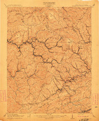
~ Pocahontas Special WV topo map, 1:62500 scale, 15 X 15 Minute, Historical, 1911
Pocahontas Special, West Virginia, USGS topographic map dated 1911.
Includes geographic coordinates (latitude and longitude). This topographic map is suitable for hiking, camping, and exploring, or framing it as a wall map.
Printed on-demand using high resolution imagery, on heavy weight and acid free paper, or alternatively on a variety of synthetic materials.
Topos available on paper, Waterproof, Poly, or Tyvek. Usually shipping rolled, unless combined with other folded maps in one order.
- Product Number: USGS-5415796
- Free digital map download (high-resolution, GeoPDF): Pocahontas Special, West Virginia (file size: 11 MB)
- Map Size: please refer to the dimensions of the GeoPDF map above
- Weight (paper map): ca. 55 grams
- Map Type: POD USGS Topographic Map
- Map Series: HTMC
- Map Verison: Historical
- Cell ID: 51742
- Scan ID: 253799
- Survey Year: 1909
- Datum: Unstated
- Map Projection: Unstated
- Map published by United States Geological Survey
- Map Language: English
- Scanner Resolution: 600 dpi
- Map Cell Name: Branwell
- Grid size: 15 X 15 Minute
- Date on map: 1911
- Map Scale: 1:62500
- Geographical region: West Virginia, United States
Neighboring Maps:
All neighboring USGS topo maps are available for sale online at a variety of scales.
Spatial coverage:
Topo map Pocahontas Special, West Virginia, covers the geographical area associated the following places:
- Boissevain - Black - Smokeless - Keystone - Anawalt - Garwood - Bottom Creek - Piedmont - Arista - Rolfe - Algoma - Big Vein - Micajah - Bluestone - Simmons - Yards - Tabors - Lamar - McDowell - Pocahontas - Northfork - Eckman - Nemours - Landgraff - Maybeury - Lowe (historical) - Abbs Valley (historical) - Ennis - Algonquin (historical) - Hereford - Midway - Pageton - Clark (historical) - Weyanoke - Duhring - Upland - Elkhorn - Jenkinjones - Widemouth (historical) - Falls Mills - Coopers - Powhatan - Wolfe - Freeman - Flipping - Bluefield - Vivian - Hales Bottom - Monson - Cherokee - Lila - Montcalm - Kyle - Effler - Worth - Ruth (historical) - Bramwell - Coaldale - Skygusty - Black Wolf - Shinbrier - Crystal - Brush Fork - Giatto - Goodwill - Covel - Ashland - Gilliam - Leckie - Godfrey - McComas - Switchback - Crumpler - Bernietown - Bluewell
- Map Area ID: AREA37.537.25-81.5-81.25
- Northwest corner Lat/Long code: USGSNW37.5-81.5
- Northeast corner Lat/Long code: USGSNE37.5-81.25
- Southwest corner Lat/Long code: USGSSW37.25-81.5
- Southeast corner Lat/Long code: USGSSE37.25-81.25
- Northern map edge Latitude: 37.5
- Southern map edge Latitude: 37.25
- Western map edge Longitude: -81.5
- Eastern map edge Longitude: -81.25


