
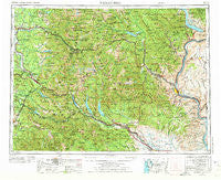
~ Wenatchee WA topo map, 1:250000 scale, 1 X 2 Degree, Historical, 1957, updated 1973
Wenatchee, Washington, USGS topographic map dated 1957.
Includes geographic coordinates (latitude and longitude). This topographic map is suitable for hiking, camping, and exploring, or framing it as a wall map.
Printed on-demand using high resolution imagery, on heavy weight and acid free paper, or alternatively on a variety of synthetic materials.
Topos available on paper, Waterproof, Poly, or Tyvek. Usually shipping rolled, unless combined with other folded maps in one order.
- Product Number: USGS-5411560
- Free digital map download (high-resolution, GeoPDF): Wenatchee, Washington (file size: 26 MB)
- Map Size: please refer to the dimensions of the GeoPDF map above
- Weight (paper map): ca. 55 grams
- Map Type: POD USGS Topographic Map
- Map Series: HTMC
- Map Verison: Historical
- Cell ID: 69093
- Scan ID: 244606
- Imprint Year: 1973
- Woodland Tint: Yes
- Aerial Photo Year: 1970
- Edit Year: 1971
- Field Check Year: 1957
- Datum: Unstated
- Map Projection: Transverse Mercator
- Map published by United States Geological Survey
- Map Language: English
- Scanner Resolution: 600 dpi
- Map Cell Name: Wenatchee
- Grid size: 1 X 2 Degree
- Date on map: 1957
- Map Scale: 1:250000
- Geographical region: Washington, United States
Neighboring Maps:
All neighboring USGS topo maps are available for sale online at a variety of scales.
Spatial coverage:
Topo map Wenatchee, Washington, covers the geographical area associated the following places:
- Leavenworth - Garcia - Ragnar - Riverbend Mobile Home Park - Sultan - Junction - Thorp - Waterville - Timberline Mobile Home Village - Cashmere - Olds - Bayne Junction - Skykomish - Foothills Senior Mobile Home Park - Lake Roesiger - Fall City Mobile Park - Landsburg - Georgetown - Nordrum (historical) - Granite Falls - Hobart - Cabin Creek - Snoqualmie Pass - Misty Mountain Mobile Home Park - Ernies Grove - Trinidad - Kanaskat Junction - McDaniels Mobile Village - High Point - Stayman - Harman Heights - Stillwater - Mountain Villa Mobile Manor - Krain - Dryden - Baring - Easton - Bagley Junction - Martin - Monroe Mobile Home Park - Berne - Liberty - Miller River - Farris - Halford - Hay Canyon Mobile Home Park - Tanner - Mount Si Mobile Home Park - Greens Landing - Sunnyslope - Riverbend - Startup - Voltage - Hyak - Page - Pine Glen - Lauderdale Junction - Forest Glade - Ravensdale - Dutch Settlement - Conifer Mobile Home Park - Cumberland - High Rock - Chumstick - Terrace Park - Snoose Junction - Monroe - Wenatchee - Lavender - Edgewick - Bandera - Kachess Resort - North Sultan - Nagrom - Shrine Beach - Entiat (historical) - Cle Elum - Blewett (historical) - Snoqualmie - Selfs Trailer Park - Saddleview Mobile Home Park - Chiwaukum - Maywood - Carnation Mobile Haven - Twin Peaks Manor Mobile Home Park - Kangley - Meadow Ridge Mobile Home Park - Teanaway - Palmer - Rock Island - Novelty - Spring Glen - Douglas - Kanaskat - Lester - Ellisville - Telma - Reiter - Lake Marcel - East Wenatchee Bench
- Map Area ID: AREA4847-122-120
- Northwest corner Lat/Long code: USGSNW48-122
- Northeast corner Lat/Long code: USGSNE48-120
- Southwest corner Lat/Long code: USGSSW47-122
- Southeast corner Lat/Long code: USGSSE47-120
- Northern map edge Latitude: 48
- Southern map edge Latitude: 47
- Western map edge Longitude: -122
- Eastern map edge Longitude: -120


