
~ Pullman WA topo map, 1:250000 scale, 1 X 2 Degree, Historical, 1958
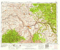
Pullman, Washington, USGS topographic map dated 1958.
Includes geographic coordinates (latitude and longitude). This topographic map is suitable for hiking, camping, and exploring, or framing it as a wall map.
Printed on-demand using high resolution imagery, on heavy weight and acid free paper, or alternatively on a variety of synthetic materials.
Topos available on paper, Waterproof, Poly, or Tyvek. Usually shipping rolled, unless combined with other folded maps in one order.
- Product Number: USGS-5411508
- Free digital map download (high-resolution, GeoPDF): Pullman, Washington (file size: 24 MB)
- Map Size: please refer to the dimensions of the GeoPDF map above
- Weight (paper map): ca. 55 grams
- Map Type: POD USGS Topographic Map
- Map Series: HTMC
- Map Verison: Historical
- Cell ID: 68977
- Scan ID: 243310
- Woodland Tint: Yes
- Field Check Year: 1955
- Datum: Unstated
- Map Projection: Transverse Mercator
- Map published by United States Army Corps of Engineers
- Map published by United States Army
- Map Language: English
- Scanner Resolution: 600 dpi
- Map Cell Name: Pullman
- Grid size: 1 X 2 Degree
- Date on map: 1958
- Map Scale: 1:250000
- Geographical region: Washington, United States
Neighboring Maps:
All neighboring USGS topo maps are available for sale online at a variety of scales.
Spatial coverage:
Topo map Pullman, Washington, covers the geographical area associated the following places:
- Webb - Craigmont - Fairburn (historical) - Five Corners - Whitlow - Vollmer - Freeze - Marengo - Winona - Kamiah - Lapwai - Johnson - Sutton - Dusty - Sherwin - Jerry - Cooper - Winona - Transfer - Hay - Peola - Stentz Spring - Jacques - Ahsahka - Swift - Busby - Arrow - Konkolville - Nora - Lewiston - Orofino - Nezperce - Thera - Cameron - Zumwalt - Pullman Junction - Mountain Top - Bovill - Grinnell - Cherrylane - Ronan - Willola - Chambers - Helmer - Houser - Princeton - Genesee - Hanson Ferry - Staley - Hampton - Taplin - Parvin - Myrtle - Fletcher - Bovard (historical) - Onaway - Woodland - Southwick - Ilo (historical) - Elk River - Clicks - Shawnee - Wilcox - Lenville - Covello - Pardee - Gould City - Jamestown (historical) - Yale (historical) - Brunning - Avon - Moscow - Delaney - Pullman - German Settlement - Armstrong - Purrington - Vineland - Union Center - Advent Hollow (historical) - Crescent - Culdesac - Slocum - Lenore - Wawawai (historical) - Risbeck - North Lewiston - Peck - Juliaetta - Lewiston Orchards - Craig Junction - Glenwood - Forest - Cornwall - Bundy - Keeler - Theon (historical) - Potlatch - Slickpoo - Cavendish
- Map Area ID: AREA4746-118-116
- Northwest corner Lat/Long code: USGSNW47-118
- Northeast corner Lat/Long code: USGSNE47-116
- Southwest corner Lat/Long code: USGSSW46-118
- Southeast corner Lat/Long code: USGSSE46-116
- Northern map edge Latitude: 47
- Southern map edge Latitude: 46
- Western map edge Longitude: -118
- Eastern map edge Longitude: -116


