
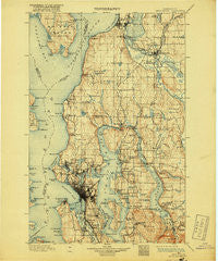
~ Snohomish WA topo map, 1:125000 scale, 30 X 30 Minute, Historical, 1897, updated 1918
Snohomish, Washington, USGS topographic map dated 1897.
Includes geographic coordinates (latitude and longitude). This topographic map is suitable for hiking, camping, and exploring, or framing it as a wall map.
Printed on-demand using high resolution imagery, on heavy weight and acid free paper, or alternatively on a variety of synthetic materials.
Topos available on paper, Waterproof, Poly, or Tyvek. Usually shipping rolled, unless combined with other folded maps in one order.
- Product Number: USGS-5411350
- Free digital map download (high-resolution, GeoPDF): Snohomish, Washington (file size: 10 MB)
- Map Size: please refer to the dimensions of the GeoPDF map above
- Weight (paper map): ca. 55 grams
- Map Type: POD USGS Topographic Map
- Map Series: HTMC
- Map Verison: Historical
- Cell ID: 66651
- Scan ID: 243814
- Imprint Year: 1918
- Survey Year: 1895
- Datum: Unstated
- Map Projection: Unstated
- Map published by United States Geological Survey
- Map Language: English
- Scanner Resolution: 600 dpi
- Map Cell Name: Snohomish
- Grid size: 30 X 30 Minute
- Date on map: 1897
- Map Scale: 1:125000
- Geographical region: Washington, United States
Neighboring Maps:
All neighboring USGS topo maps are available for sale online at a variety of scales.
Spatial coverage:
Topo map Snohomish, Washington, covers the geographical area associated the following places:
- Paramount Park - Sunlight Beach - Roosevelt - Seattle Heights Mobile Home Park - Kennard Mobile Estates - Richmond Beach - Lake Stickney - Edgewater - Lucerne - Cottage Lake - Thunderbird Mobile Home Park - Medo Lynn Mobile Home Park - Ross (historical) - Capitol Hill - Richmond Highlands - Endolyne - Ballard - Foy - Manitou - West Seattle - Mukilteo - Beacon Hill - Lawton - Cougar Hills - Kingsbury West Mobile Home Park - Northrup - Moorland - Country Club Senior Mobile Park - Snohomish - Portage Bay - Lynnwood Mobile Park - Mountlake Terrace - Firdale - Bella Mobile Home Park - University District - Madison Park - Valley View Mobile Manor - Youngs Mobile Home Park - Rainier Valley - Courtyard Mobile Home Park - Montlake - Machias - Ridge Acres Mobile Home Park - Canyon Recreational Vehicle Park - Moorlands - South Seattle - Roanoke - Meridian Village Mobile Home - East Seattle - The Highlands - Mercer Heights - Interbay - Beaux Arts Village - Cedar Valley - Lost Lake Mobile Home Park - Royal Coachman Mobile Home Park - Cascade Vista Mobile Estates - Lakewood Villa Mobile Home Park - Jamison Corner - Matthews Beach - Laurelhurst - Pinehurst - Hilltop - Seward Park - Adelaide - Pine Lake - Crown Hill - Delridge - Bryn Mawr Properties Mobile Home Park - North Creek - Clearview - Echo Lake - Robinswood - Magnolia Bluff - Willows - Bryn Mawr - Newport - Columbia - Royalwood Mobile Home Estates - Ridgecrest - Mill Creek - Bromart - Crossroads - Creekside Mobile Home Park - Frontier Manor Mobile Home Park - Beardens Mobile Home Park - Eastland - North Broadway - Village Green Mobile Home Park - Freeway Place Mobile Home Park - Briarcrest - Westridge Estates Mobile Home Park - Earlmont - Overlake - Lawtonwood - River Shores Mobile Home Park - Kenwood - Mercer Island Town - Blue Ridge - Wedgwood
- Map Area ID: AREA4847.5-122.5-122
- Northwest corner Lat/Long code: USGSNW48-122.5
- Northeast corner Lat/Long code: USGSNE48-122
- Southwest corner Lat/Long code: USGSSW47.5-122.5
- Southeast corner Lat/Long code: USGSSE47.5-122
- Northern map edge Latitude: 48
- Southern map edge Latitude: 47.5
- Western map edge Longitude: -122.5
- Eastern map edge Longitude: -122


