
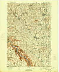
~ Pullman WA topo map, 1:125000 scale, 30 X 30 Minute, Historical, 1910, updated 1926
Pullman, Washington, USGS topographic map dated 1910.
Includes geographic coordinates (latitude and longitude). This topographic map is suitable for hiking, camping, and exploring, or framing it as a wall map.
Printed on-demand using high resolution imagery, on heavy weight and acid free paper, or alternatively on a variety of synthetic materials.
Topos available on paper, Waterproof, Poly, or Tyvek. Usually shipping rolled, unless combined with other folded maps in one order.
- Product Number: USGS-5411302
- Free digital map download (high-resolution, GeoPDF): Pullman, Washington (file size: 12 MB)
- Map Size: please refer to the dimensions of the GeoPDF map above
- Weight (paper map): ca. 55 grams
- Map Type: POD USGS Topographic Map
- Map Series: HTMC
- Map Verison: Historical
- Cell ID: 66402
- Scan ID: 243306
- Imprint Year: 1926
- Survey Year: 1905
- Datum: Unstated
- Map Projection: Polyconic
- Map published by United States Geological Survey
- Map Language: English
- Scanner Resolution: 600 dpi
- Map Cell Name: Pullnam
- Grid size: 30 X 30 Minute
- Date on map: 1910
- Map Scale: 1:125000
- Geographical region: Washington, United States
Neighboring Maps:
All neighboring USGS topo maps are available for sale online at a variety of scales.
Spatial coverage:
Topo map Pullman, Washington, covers the geographical area associated the following places:
- Palouse - Viola - Madson - Ladow - Yellow Dog (historical) - Wilcox - Ewartsville - Jamestown (historical) - Mayview - Armstrong - Mockonema - Colfax - Whelan - Busby - Moscow - Whitlow - Pullman Junction - Union Center - Diamond - Risbeck - Kitzmiller - Glenwood - Lairds - Colton - Fallon - Leon - Elberton - Sunshine - Ringo - Chambers - Wilma (historical) - Pullman - Uniontown - Buswell (historical) - Leon - Johnson - Wawawai (historical) - Shawnee - Parvin - Manning - Kirby - Albion - Grinnell - Harpole - Staley - Almota - Estes
- Map Area ID: AREA4746.5-117.5-117
- Northwest corner Lat/Long code: USGSNW47-117.5
- Northeast corner Lat/Long code: USGSNE47-117
- Southwest corner Lat/Long code: USGSSW46.5-117.5
- Southeast corner Lat/Long code: USGSSE46.5-117
- Northern map edge Latitude: 47
- Southern map edge Latitude: 46.5
- Western map edge Longitude: -117.5
- Eastern map edge Longitude: -117


