
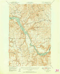
~ Turtle Lake WA topo map, 1:62500 scale, 15 X 15 Minute, Historical, 1950
Turtle Lake, Washington, USGS topographic map dated 1950.
Includes geographic coordinates (latitude and longitude). This topographic map is suitable for hiking, camping, and exploring, or framing it as a wall map.
Printed on-demand using high resolution imagery, on heavy weight and acid free paper, or alternatively on a variety of synthetic materials.
Topos available on paper, Waterproof, Poly, or Tyvek. Usually shipping rolled, unless combined with other folded maps in one order.
- Product Number: USGS-5410798
- Free digital map download (high-resolution, GeoPDF): Turtle Lake, Washington (file size: 10 MB)
- Map Size: please refer to the dimensions of the GeoPDF map above
- Weight (paper map): ca. 55 grams
- Map Type: POD USGS Topographic Map
- Map Series: HTMC
- Map Verison: Historical
- Cell ID: 63766
- Scan ID: 244369
- Aerial Photo Year: 1946
- Field Check Year: 1948
- Datum: NAD27
- Map Projection: Polyconic
- Map published by United States Army Corps of Engineers
- Map Language: English
- Scanner Resolution: 600 dpi
- Map Cell Name: Turtle Lake
- Grid size: 15 X 15 Minute
- Date on map: 1950
- Map Scale: 1:62500
- Geographical region: Washington, United States
Neighboring Maps:
All neighboring USGS topo maps are available for sale online at a variety of scales.
Spatial coverage:
Topo map Turtle Lake, Washington, covers the geographical area associated the following places:
- Egypt Church - Fouress Mine - Saint Augustine School - Sand Flat - Blue Creek - Green Canyon - Spokane Tribal Ambulance - Alder Creek - Pitney Butte - Porcupine Bay Campground - Oyachen Creek - Owl Creek - Harker Canyon - McCoy Lake - Sherwood Project Tailings Dam - Orazada Mine - Sand Creek - Carp Lake - Wellpinit Mountain - Turtle Lake - Pitney Creek - Spokane Reservation - West End Church - Porcupine Bay - Hollies Creek - Spokane Mountain - Grouse Ridge - Deer Mountain - Blue Creek Camp - Mill Canyon - Spokane Molybdenum Mine - Inkster Lake - Germania Consolidated Mine - Midnight Mine - Spokane River Arm - Spokane Reservation Division - Tamarack Flat - Church of Our Lady of Lourdes - Detillion Campground - Cayuse Mountain - Egypt - Ferguson Creek - Lilienthal Mountain - Lincoln County Fire District 5 Egypt Station - Bear Mountain - North Star Grange - Benjamin Lake - Sherwood Mine - Orazada Creek - Rail Creek
- Map Area ID: AREA4847.75-118.25-118
- Northwest corner Lat/Long code: USGSNW48-118.25
- Northeast corner Lat/Long code: USGSNE48-118
- Southwest corner Lat/Long code: USGSSW47.75-118.25
- Southeast corner Lat/Long code: USGSSE47.75-118
- Northern map edge Latitude: 48
- Southern map edge Latitude: 47.75
- Western map edge Longitude: -118.25
- Eastern map edge Longitude: -118


