
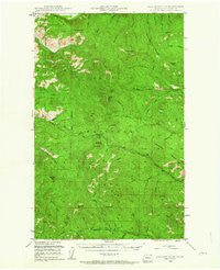
~ Togo Mountain WA topo map, 1:62500 scale, 15 X 15 Minute, Historical, 1948, updated 1963
Togo Mountain, Washington, USGS topographic map dated 1948.
Includes geographic coordinates (latitude and longitude). This topographic map is suitable for hiking, camping, and exploring, or framing it as a wall map.
Printed on-demand using high resolution imagery, on heavy weight and acid free paper, or alternatively on a variety of synthetic materials.
Topos available on paper, Waterproof, Poly, or Tyvek. Usually shipping rolled, unless combined with other folded maps in one order.
- Product Number: USGS-5410780
- Free digital map download (high-resolution, GeoPDF): Togo Mountain, Washington (file size: 11 MB)
- Map Size: please refer to the dimensions of the GeoPDF map above
- Weight (paper map): ca. 55 grams
- Map Type: POD USGS Topographic Map
- Map Series: HTMC
- Map Verison: Historical
- Cell ID: 63599
- Scan ID: 244303
- Imprint Year: 1963
- Woodland Tint: Yes
- Aerial Photo Year: 1944
- Field Check Year: 1948
- Datum: NAD27
- Map Projection: Polyconic
- Map published by United States Forest Service
- Map Language: English
- Scanner Resolution: 600 dpi
- Map Cell Name: Togo Mountain
- Grid size: 15 X 15 Minute
- Date on map: 1948
- Map Scale: 1:62500
- Geographical region: Washington, United States
Neighboring Maps:
All neighboring USGS topo maps are available for sale online at a variety of scales.
Spatial coverage:
Topo map Togo Mountain, Washington, covers the geographical area associated the following places:
- Wheeler Creek - Ryan Hill - North Creek - Goat Creek - Mick Creek - Middle Fork Little Boulder Creek - Boulder Creek Pass - Kettle River Range - Tonasket Mountain - Taylor Ridge - Green Mountain - Bulldog Mountain - Indian Creek - Slide Creek - Grouse Mountain - Hunter Creek - Onion Creek - Midget Creek - North Creek - Third Creek - North Fork Little Boulder Creek - Tamarack spring - Owl Mountain - Independent Mountain - Mount Leona - Dry Creek - Rocky Mountain - Laddie Creek - South Fork Little Boulder Creek - Butte Fork - Ryan Cabin - Williams Creek - U S Creek - Noonday Spring - Manley Creek - Huckleberry Ridge - Table Spring - Jungle Creek - North Fork Lone Ranch Creek - Cabin Creek - Slide Spring - First Creek - Sentinel Butte - Marble Mountain - Second Creek - Bulldog Creek - Jasper Mountain - Roesheisen Creek - Rabbit Mountain - Trio Creek - Friday Creek - Summit Guard Station - Deer Creek Summit Campground - Dry Mountain - Togo Mountain - North Boulder Ridge - Boundary Mountain - Profanity Peak
- Map Area ID: AREA4948.75-118.5-118.25
- Northwest corner Lat/Long code: USGSNW49-118.5
- Northeast corner Lat/Long code: USGSNE49-118.25
- Southwest corner Lat/Long code: USGSSW48.75-118.5
- Southeast corner Lat/Long code: USGSSE48.75-118.25
- Northern map edge Latitude: 49
- Southern map edge Latitude: 48.75
- Western map edge Longitude: -118.5
- Eastern map edge Longitude: -118.25


