
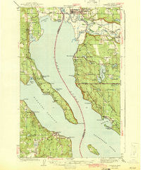
~ Stanwood WA topo map, 1:62500 scale, 15 X 15 Minute, Historical, 1943
Stanwood, Washington, USGS topographic map dated 1943.
Includes geographic coordinates (latitude and longitude). This topographic map is suitable for hiking, camping, and exploring, or framing it as a wall map.
Printed on-demand using high resolution imagery, on heavy weight and acid free paper, or alternatively on a variety of synthetic materials.
Topos available on paper, Waterproof, Poly, or Tyvek. Usually shipping rolled, unless combined with other folded maps in one order.
- Product Number: USGS-5410728
- Free digital map download (high-resolution, GeoPDF): Stanwood, Washington (file size: 7 MB)
- Map Size: please refer to the dimensions of the GeoPDF map above
- Weight (paper map): ca. 55 grams
- Map Type: POD USGS Topographic Map
- Map Series: HTMC
- Map Verison: Historical
- Cell ID: 62921
- Scan ID: 243996
- Woodland Tint: Yes
- Survey Year: 1940
- Datum: NAD27
- Map Projection: Polyconic
- Map published by United States Geological Survey
- Map Language: English
- Scanner Resolution: 600 dpi
- Map Cell Name: Stanwood
- Grid size: 15 X 15 Minute
- Date on map: 1943
- Map Scale: 1:62500
- Geographical region: Washington, United States
Neighboring Maps:
All neighboring USGS topo maps are available for sale online at a variety of scales.
Spatial coverage:
Topo map Stanwood, Washington, covers the geographical area associated the following places:
- Silvana - Sunny Shore Acres - Wheel Estates Mobile Home Park - Sunny Shores - New Utsaladdy - Mission Beach - Cathan - Lake Ki Mobile Home Park - Camp Diana - Driftwood Shores - Weallup Lake - Warm Beach - Bay View - Tyee Beach - Saratoga - Langley - Lona Beach - Bretland - Priest Point - Terrys Corner - Tulare Beach - Warm Beach Estates Mobile Home Park - Bells Beach - Silvana Terraces - East Stanwood - Florence - Tulalip Bay - Lake Goodwin - Stanwood - McKees Beach - Norman - Seven Lakes Mobile Home Park - Juniper Beach - Tulalip - Mabana - Pebble Beach - Spee-Bi-Dah
- Map Area ID: AREA48.2548-122.5-122.25
- Northwest corner Lat/Long code: USGSNW48.25-122.5
- Northeast corner Lat/Long code: USGSNE48.25-122.25
- Southwest corner Lat/Long code: USGSSW48-122.5
- Southeast corner Lat/Long code: USGSSE48-122.25
- Northern map edge Latitude: 48.25
- Southern map edge Latitude: 48
- Western map edge Longitude: -122.5
- Eastern map edge Longitude: -122.25


