
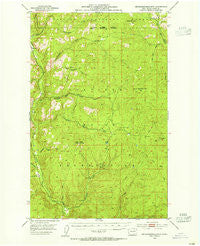
~ Seventeenmile Mtn WA topo map, 1:62500 scale, 15 X 15 Minute, Historical, 1953, updated 1955
Seventeenmile Mtn , Washington, USGS topographic map dated 1953.
Includes geographic coordinates (latitude and longitude). This topographic map is suitable for hiking, camping, and exploring, or framing it as a wall map.
Printed on-demand using high resolution imagery, on heavy weight and acid free paper, or alternatively on a variety of synthetic materials.
Topos available on paper, Waterproof, Poly, or Tyvek. Usually shipping rolled, unless combined with other folded maps in one order.
- Product Number: USGS-5410652
- Free digital map download (high-resolution, GeoPDF): Seventeenmile Mtn , Washington (file size: 9 MB)
- Map Size: please refer to the dimensions of the GeoPDF map above
- Weight (paper map): ca. 55 grams
- Map Type: POD USGS Topographic Map
- Map Series: HTMC
- Map Verison: Historical
- Cell ID: 62353
- Scan ID: 243676
- Imprint Year: 1955
- Woodland Tint: Yes
- Aerial Photo Year: 1946
- Field Check Year: 1953
- Datum: NAD27
- Map Projection: Polyconic
- Map published by United States Geological Survey
- Map Language: English
- Scanner Resolution: 600 dpi
- Map Cell Name: Seventeenmile Mountain
- Grid size: 15 X 15 Minute
- Date on map: 1953
- Map Scale: 1:62500
- Geographical region: Washington, United States
Neighboring Maps:
All neighboring USGS topo maps are available for sale online at a variety of scales.
Spatial coverage:
Topo map Seventeenmile Mtn , Washington, covers the geographical area associated the following places:
- Paint Rock Lookout - North Nanamkin Creek - South Seventeenmile Creek - Thirteenmile Creek - Cody Butte - Twentyone Mile Creek - Thirtymile Creek - Thirteenmile Campground - Thirteenmile Hiking Trail - Ferry County - Nineteenmile Creek - Seventeenmile Creek - Cody Lake - Twentyone Mile Campground - Seventeenmile Trail - South Seventeenmile Mountain - West Fork Sanpoil River - Paint Rock - Hall Creek Road - Rattlesnake Gulch - North Fork Hall Creek - Cub Creek - Anderson Creek - Thirteenmile Road - Twentythree Mile Creek - Devils Elbow - Deadhorse Creek - West Fork Hall Creek - South Nanamkin Creek - Twentyfive Mile Creek - Bear Creek - Seventeenmile Mountain - Daisy Trail - Cody Butte Lookout
- Map Area ID: AREA48.548.25-118.75-118.5
- Northwest corner Lat/Long code: USGSNW48.5-118.75
- Northeast corner Lat/Long code: USGSNE48.5-118.5
- Southwest corner Lat/Long code: USGSSW48.25-118.75
- Southeast corner Lat/Long code: USGSSE48.25-118.5
- Northern map edge Latitude: 48.5
- Southern map edge Latitude: 48.25
- Western map edge Longitude: -118.75
- Eastern map edge Longitude: -118.5


