
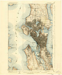
~ Seattle WA topo map, 1:62500 scale, 15 X 15 Minute, Historical, 1909, updated 1936
Seattle, Washington, USGS topographic map dated 1909.
Includes geographic coordinates (latitude and longitude). This topographic map is suitable for hiking, camping, and exploring, or framing it as a wall map.
Printed on-demand using high resolution imagery, on heavy weight and acid free paper, or alternatively on a variety of synthetic materials.
Topos available on paper, Waterproof, Poly, or Tyvek. Usually shipping rolled, unless combined with other folded maps in one order.
- Product Number: USGS-5410648
- Free digital map download (high-resolution, GeoPDF): Seattle, Washington (file size: 10 MB)
- Map Size: please refer to the dimensions of the GeoPDF map above
- Weight (paper map): ca. 55 grams
- Map Type: POD USGS Topographic Map
- Map Series: HTMC
- Map Verison: Historical
- Cell ID: 62236
- Scan ID: 243643
- Imprint Year: 1936
- Survey Year: 1893
- Datum: Unstated
- Map Projection: Polyconic
- Map published by United States Geological Survey
- Map Language: English
- Scanner Resolution: 600 dpi
- Map Cell Name: Seattle
- Grid size: 15 X 15 Minute
- Date on map: 1909
- Map Scale: 1:62500
- Geographical region: Washington, United States
Neighboring Maps:
All neighboring USGS topo maps are available for sale online at a variety of scales.
Spatial coverage:
Topo map Seattle, Washington, covers the geographical area associated the following places:
- Lawton - Brighton - Evergreen - Holly Park - Stevens - Suburban Villa Mobile Home Park - Queen Anne - Loyal Heights - Yesler Terrace - Cedar Park - West Seattle - Seward Park - Endolyne - North Park - Montlake - Ravenna - Broadview - Mann - Broadmoor - Halcyon Mobile Home Park - Fauntleroy - Edgewater Park - Metum - Meridian - Lake City - Alki - Ridgecrest - Windermere - Capitol Hill - Bitter Lake - Dunlap - Laurelhurst - Roosevelt - Columbia City - Edgewater (historical) - Van Asselt - Beacon Hill - Haller Lake - Wedgwood - Victory Heights - Ballard - High Point - Rainier Beach - Wallingford - Yeomalt - Arbor Heights - Olympic Hills - Tamill - Belltown - Roxbury Heights - Manitou - Fremont - Greenwood - Paramount Park - Bella Mobile Home Park - Latona (historical) - Pontiac - Arroyo Heights - Madison Park - Youngstown - South Park - View Ridge - Spring Beach - Columbia - Jensen Trailer Mobile Home Court - Portage Bay - North Broadway - Briarcrest - Hillman City (historical) - West Woodland - University Village - White Center - Seattle - Foy - Pinehurst - Glendale - Georgetown - Briercrest - Mount Baker - Whittier Heights - Blue Ridge - Duwamish - Madrona - Delridge - Sunset Hill - Green Lake - Rainier Valley - North College Park - Interbay - Hawthorne Hills - Morningside - Magnolia Bluff - Phinney Ridge - North Beach - Lakewood - The Highlands - Westward Mobile Park - University - Carlton Park - Crown Hill
- Map Area ID: AREA47.7547.5-122.5-122.25
- Northwest corner Lat/Long code: USGSNW47.75-122.5
- Northeast corner Lat/Long code: USGSNE47.75-122.25
- Southwest corner Lat/Long code: USGSSW47.5-122.5
- Southeast corner Lat/Long code: USGSSE47.5-122.25
- Northern map edge Latitude: 47.75
- Southern map edge Latitude: 47.5
- Western map edge Longitude: -122.5
- Eastern map edge Longitude: -122.25


