
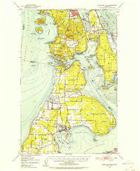
~ Deception Pass WA topo map, 1:62500 scale, 15 X 15 Minute, Historical, 1951, updated 1953
Deception Pass, Washington, USGS topographic map dated 1951.
Includes geographic coordinates (latitude and longitude). This topographic map is suitable for hiking, camping, and exploring, or framing it as a wall map.
Printed on-demand using high resolution imagery, on heavy weight and acid free paper, or alternatively on a variety of synthetic materials.
Topos available on paper, Waterproof, Poly, or Tyvek. Usually shipping rolled, unless combined with other folded maps in one order.
- Product Number: USGS-5409736
- Free digital map download (high-resolution, GeoPDF): Deception Pass, Washington (file size: 8 MB)
- Map Size: please refer to the dimensions of the GeoPDF map above
- Weight (paper map): ca. 55 grams
- Map Type: POD USGS Topographic Map
- Map Series: HTMC
- Map Verison: Historical
- Cell ID: 53284
- Scan ID: 240807
- Imprint Year: 1953
- Woodland Tint: Yes
- Field Check Year: 1951
- Survey Year: 1940
- Datum: NAD27
- Map Projection: Polyconic
- Map published by United States Geological Survey
- Map Language: English
- Scanner Resolution: 600 dpi
- Map Cell Name: Deception Pass
- Grid size: 15 X 15 Minute
- Date on map: 1951
- Map Scale: 1:62500
- Geographical region: Washington, United States
Neighboring Maps:
All neighboring USGS topo maps are available for sale online at a variety of scales.
Spatial coverage:
Topo map Deception Pass, Washington, covers the geographical area associated the following places:
- Maple Grove Beach - Valley High Mobile Park - Oak Hollow Mobile Home Park - Parkwood Manor Mobile Home Park - Island Park Manufactured Home Park - Whitmarsh Junction - Alexander Beach - Swantown - Harborview Mobile Home Park - Shelter Bay - Town and Country Mobile Home Park - Howards Corner - Oak Harbor - Gibraltar - Marketown - Cornet - Sharpes Corner - Wagon Wheel Mobile Home Park - Fidalgo - Yokeko Point - Snee Oosh - Rosario Beach - Similk Beach - Swinomish Village - West Shore - Windmill Mobile Home Courts - Country Place Mobile Home Park - Dewey - Fort Knox Mobile Home Park - Western Village Mobile Estates
- Map Area ID: AREA48.548.25-122.75-122.5
- Northwest corner Lat/Long code: USGSNW48.5-122.75
- Northeast corner Lat/Long code: USGSNE48.5-122.5
- Southwest corner Lat/Long code: USGSSW48.25-122.75
- Southeast corner Lat/Long code: USGSSE48.25-122.5
- Northern map edge Latitude: 48.5
- Southern map edge Latitude: 48.25
- Western map edge Longitude: -122.75
- Eastern map edge Longitude: -122.5


