
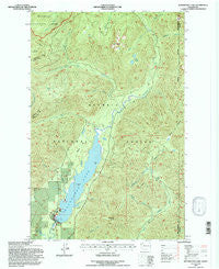
~ Wynoochee Lake WA topo map, 1:24000 scale, 7.5 X 7.5 Minute, Historical, 1995, updated 1997
Wynoochee Lake, Washington, USGS topographic map dated 1995.
Includes geographic coordinates (latitude and longitude). This topographic map is suitable for hiking, camping, and exploring, or framing it as a wall map.
Printed on-demand using high resolution imagery, on heavy weight and acid free paper, or alternatively on a variety of synthetic materials.
Topos available on paper, Waterproof, Poly, or Tyvek. Usually shipping rolled, unless combined with other folded maps in one order.
- Product Number: USGS-5409388
- Free digital map download (high-resolution, GeoPDF): Wynoochee Lake, Washington (file size: 18 MB)
- Map Size: please refer to the dimensions of the GeoPDF map above
- Weight (paper map): ca. 55 grams
- Map Type: POD USGS Topographic Map
- Map Series: HTMC
- Map Verison: Historical
- Cell ID: 49970
- Scan ID: 244791
- Imprint Year: 1997
- Woodland Tint: Yes
- Aerial Photo Year: 1989
- Edit Year: 1995
- Datum: NAD27
- Map Projection: Lambert Conformal Conic
- Map published by United States Forest Service
- Map Language: English
- Scanner Resolution: 600 dpi
- Map Cell Name: Wynoochee Lake
- Grid size: 7.5 X 7.5 Minute
- Date on map: 1995
- Map Scale: 1:24000
- Geographical region: Washington, United States
Neighboring Maps:
All neighboring USGS topo maps are available for sale online at a variety of scales.
Spatial coverage:
Topo map Wynoochee Lake, Washington, covers the geographical area associated the following places:
- Schafer Creek - Schofield Creek - Wynoochee Falls Campground - Wynoochee Dam - Klone Lakes - Three Peaks - Beaver Flat - Mount Church - Wynoochee Dam Visitor Center - Anderson Butte - Chapel Peak - Satsop Lakes - Trout Creek - Clark Creek - Coho Campground - Wynoochee Lake - Wynoochee Shelter - Pederson Creek - Anderson Butte Lookout - Copper Creek - Sixteen Creek - West Branch Wynoochee River - Eleanor Creek - North Fork West Branch Wynoochee River - Scatter Creek
- Map Area ID: AREA47.547.375-123.625-123.5
- Northwest corner Lat/Long code: USGSNW47.5-123.625
- Northeast corner Lat/Long code: USGSNE47.5-123.5
- Southwest corner Lat/Long code: USGSSW47.375-123.625
- Southeast corner Lat/Long code: USGSSE47.375-123.5
- Northern map edge Latitude: 47.5
- Southern map edge Latitude: 47.375
- Western map edge Longitude: -123.625
- Eastern map edge Longitude: -123.5


