
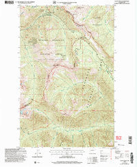
~ Slate Peak WA topo map, 1:24000 scale, 7.5 X 7.5 Minute, Historical, 2002, updated 2006
Slate Peak, Washington, USGS topographic map dated 2002.
Includes geographic coordinates (latitude and longitude). This topographic map is suitable for hiking, camping, and exploring, or framing it as a wall map.
Printed on-demand using high resolution imagery, on heavy weight and acid free paper, or alternatively on a variety of synthetic materials.
Topos available on paper, Waterproof, Poly, or Tyvek. Usually shipping rolled, unless combined with other folded maps in one order.
- Product Number: USGS-5408044
- Free digital map download (high-resolution, GeoPDF): Slate Peak, Washington (file size: 19 MB)
- Map Size: please refer to the dimensions of the GeoPDF map above
- Weight (paper map): ca. 55 grams
- Map Type: POD USGS Topographic Map
- Map Series: HTMC
- Map Verison: Historical
- Cell ID: 41657
- Scan ID: 243773
- Imprint Year: 2006
- Woodland Tint: Yes
- Aerial Photo Year: 2002
- Edit Year: 2002
- Datum: NAD83
- Map Projection: Universal Transverse Mercator
- Map published by United States Forest Service
- Map Language: English
- Scanner Resolution: 600 dpi
- Map Cell Name: Slate Peak
- Grid size: 7.5 X 7.5 Minute
- Date on map: 2002
- Map Scale: 1:24000
- Geographical region: Washington, United States
Neighboring Maps:
All neighboring USGS topo maps are available for sale online at a variety of scales.
Spatial coverage:
Topo map Slate Peak, Washington, covers the geographical area associated the following places:
- North Fork Trout Creek - Grasshopper Pass - Slate Pass - Arralde Creek - Illinois Mine - Cataract Creek - Tatie Peak - Haystack Mountain - Harts Pass - Brush Creek - Goat Mine - Horse Heaven Camp - West Fork Methow Trail - Tower Creek - Handcock Ridge - Brown Bear Mine - Harts Pass Trailhead - Leap Creek - Horse Heaven - South Fork Trout Creek - Jet Creek - Meadows Campground - Layout Camp - Ninetynine Basin - Whistler Mine - Glacier Pass - Rattlesnake Creek - Deer Park Camp - Dicky Creek - Needle Creek - Slate Peak
- Map Area ID: AREA48.7548.625-120.75-120.625
- Northwest corner Lat/Long code: USGSNW48.75-120.75
- Northeast corner Lat/Long code: USGSNE48.75-120.625
- Southwest corner Lat/Long code: USGSSW48.625-120.75
- Southeast corner Lat/Long code: USGSSE48.625-120.625
- Northern map edge Latitude: 48.75
- Southern map edge Latitude: 48.625
- Western map edge Longitude: -120.75
- Eastern map edge Longitude: -120.625


