
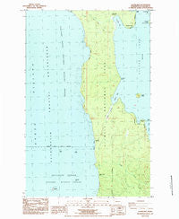
~ Allens Bay WA topo map, 1:24000 scale, 7.5 X 7.5 Minute, Historical, 1984, updated 1984
Allens Bay, Washington, USGS topographic map dated 1984.
Includes geographic coordinates (latitude and longitude). This topographic map is suitable for hiking, camping, and exploring, or framing it as a wall map.
Printed on-demand using high resolution imagery, on heavy weight and acid free paper, or alternatively on a variety of synthetic materials.
Topos available on paper, Waterproof, Poly, or Tyvek. Usually shipping rolled, unless combined with other folded maps in one order.
- Product Number: USGS-5402372
- Free digital map download (high-resolution, GeoPDF): Allens Bay, Washington (file size: 14 MB)
- Map Size: please refer to the dimensions of the GeoPDF map above
- Weight (paper map): ca. 55 grams
- Map Type: POD USGS Topographic Map
- Map Series: HTMC
- Map Verison: Historical
- Cell ID: 612
- Scan ID: 239790
- Imprint Year: 1984
- Woodland Tint: Yes
- Aerial Photo Year: 1978
- Edit Year: 1984
- Field Check Year: 1979
- Datum: NAD27
- Map Projection: Lambert Conformal Conic
- Provisional map: Yes
- Map published by United States Geological Survey
- Map Language: English
- Scanner Resolution: 600 dpi
- Map Cell Name: Allens Bay
- Grid size: 7.5 X 7.5 Minute
- Date on map: 1984
- Map Scale: 1:24000
- Geographical region: Washington, United States
Neighboring Maps:
All neighboring USGS topo maps are available for sale online at a variety of scales.
Spatial coverage:
Topo map Allens Bay, Washington, covers the geographical area associated the following places:
- Jersted Point - Cemetery Point - Tivoli Island - Norwegian Memorial - Allens Bay Trail - Ericsons Bay - Hand Rock - Eagle Point - Yellow Banks - Shafers Point - Ozette Lake - Wish Creek - Baby Island - Foot Rock - Ericksons Bay Campground - Two Man Rock - Starbuck Mine - Allens Slough - South Sand Point Trail - Birkestol Point - Kayostia Beach - Carroll Island - Old Cemetery - Allens Bay - Cedar Creek - Umbrella Point
- Map Area ID: AREA48.12548-124.75-124.625
- Northwest corner Lat/Long code: USGSNW48.125-124.75
- Northeast corner Lat/Long code: USGSNE48.125-124.625
- Southwest corner Lat/Long code: USGSSW48-124.75
- Southeast corner Lat/Long code: USGSSE48-124.625
- Northern map edge Latitude: 48.125
- Southern map edge Latitude: 48
- Western map edge Longitude: -124.75
- Eastern map edge Longitude: -124.625


