
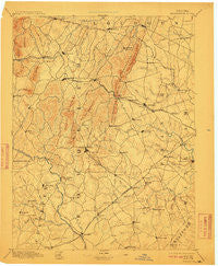
~ Warrenton VA topo map, 1:125000 scale, 30 X 30 Minute, Historical, 1894, updated 1910
Warrenton, Virginia, USGS topographic map dated 1894.
Includes geographic coordinates (latitude and longitude). This topographic map is suitable for hiking, camping, and exploring, or framing it as a wall map.
Printed on-demand using high resolution imagery, on heavy weight and acid free paper, or alternatively on a variety of synthetic materials.
Topos available on paper, Waterproof, Poly, or Tyvek. Usually shipping rolled, unless combined with other folded maps in one order.
- Product Number: USGS-5304158
- Free digital map download (high-resolution, GeoPDF): Warrenton, Virginia (file size: 7 MB)
- Map Size: please refer to the dimensions of the GeoPDF map above
- Weight (paper map): ca. 55 grams
- Map Type: POD USGS Topographic Map
- Map Series: HTMC
- Map Verison: Historical
- Cell ID: 66776
- Scan ID: 189206
- Imprint Year: 1910
- Survey Year: 1887
- Datum: Unstated
- Map Projection: Unstated
- Map published by United States Geological Survey
- Map Language: English
- Scanner Resolution: 600 dpi
- Map Cell Name: Thorofare Gap
- Grid size: 30 X 30 Minute
- Date on map: 1894
- Map Scale: 1:125000
- Geographical region: Virginia, United States
Neighboring Maps:
All neighboring USGS topo maps are available for sale online at a variety of scales.
Spatial coverage:
Topo map Warrenton, Virginia, covers the geographical area associated the following places:
- Eustacestown - Magee - Catharpin Farms Estates - Dover - Fayettesville - Greenville - Rectortown - Royville - Warrenton - Lakeview Estates - Airlie - Perrowville - Piedmont Heights - Walnut Ridge Estates - Cliff Mills - Bull Run East - Old Field Estates - Rock Hill - Waterfall - Levy - Elkwood - Westgate - Balls Mill - Frogtown - Bushy Acres - Glendale (historical) - Lenah - Haymarket - Hutchinson - Zouave Hills - Lakeland - Groveton - Crescent - Turnbull - Brandy Station - Ada - Meetze - Morgantown - Botha - Conde - Erinbrook - Snow Hill - Iron Gate - Covingtons Corner - Bristersburg - Scuffleburg - Brambleton - Landmark - Rolling Hills - Rock Hill Manors - Springfield - Ashville - Middleburg - Antioch - Carolandville - Weimertown - Mountain View Estates - Crossroads - South Wales - Crestwood Village - Bannerwood - Cedar Knolls - Beverley Mill - Ashton Glen - Long Level Estates - Fletcherville - Alwington - Mandleys Corner - Catalpa - Millbrook - Deerfield Estates - Stepney Plantation - Lois - Boxwood Farms - Doddstown - Country Scene - Brent Town - Ridgelea - Burns Crossroads - Elk Run - Woolsey - Tacketts Mill - Weaversville - Lakota - Breezy Knolls Estates - Forest Lake Estates - Forest Hills Estates - Bull Run Mountain Estates - Orlean - Palmers Crossroads - Remington - Swansen - Brent Turf Acres - Rixlew - Watson - Oak Shade - Bleak - Bataan Village - Olde South Estates - Stafford Station
- Map Area ID: AREA3938.5-78-77.5
- Northwest corner Lat/Long code: USGSNW39-78
- Northeast corner Lat/Long code: USGSNE39-77.5
- Southwest corner Lat/Long code: USGSSW38.5-78
- Southeast corner Lat/Long code: USGSSE38.5-77.5
- Northern map edge Latitude: 39
- Southern map edge Latitude: 38.5
- Western map edge Longitude: -78
- Eastern map edge Longitude: -77.5


