
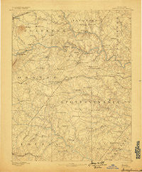
~ Spottsylvania VA topo map, 1:125000 scale, 30 X 30 Minute, Historical, 1892, updated 1898
Spottsylvania, Virginia, USGS topographic map dated 1892.
Includes geographic coordinates (latitude and longitude). This topographic map is suitable for hiking, camping, and exploring, or framing it as a wall map.
Printed on-demand using high resolution imagery, on heavy weight and acid free paper, or alternatively on a variety of synthetic materials.
Topos available on paper, Waterproof, Poly, or Tyvek. Usually shipping rolled, unless combined with other folded maps in one order.
- Product Number: USGS-5304108
- Free digital map download (high-resolution, GeoPDF): Spottsylvania, Virginia (file size: 7 MB)
- Map Size: please refer to the dimensions of the GeoPDF map above
- Weight (paper map): ca. 55 grams
- Map Type: POD USGS Topographic Map
- Map Series: HTMC
- Map Verison: Historical
- Cell ID: 66673
- Scan ID: 189170
- Imprint Year: 1898
- Survey Year: 1887
- Datum: Unstated
- Map Projection: Unstated
- Map published by United States Geological Survey
- Map Language: English
- Scanner Resolution: 600 dpi
- Map Cell Name: Spotsylvania
- Grid size: 30 X 30 Minute
- Date on map: 1892
- Map Scale: 1:125000
- Geographical region: Virginia, United States
Neighboring Maps:
All neighboring USGS topo maps are available for sale online at a variety of scales.
Spatial coverage:
Topo map Spottsylvania, Virginia, covers the geographical area associated the following places:
- Frank Martin Farms - Kimberly Estates - Paynes Corner - Milburn Estates - The Estates - Berea Plantation - Rosedale - The Willows - Margo - Glenora - Berea Estates - Pine View - Plum Tree - Mine Run - Ribbon - Greens Corner - Shackelford Estates - Stefaniga Road - Stanards Mill - Queens Guard - Davis Corner - Arcadia - Kellys Ford - Woodridge - Carrico - Quiet Woods Estate - Nora Park - Hampshire Forest - Marye - Deerfield Estates - Brokenburg - Rose Hill Farms - Country Wood Estates - Foxwood Estates - Raccoon Ford - Everona - Mansfield (historical) - Harwill Acres - Hunters Pond - Colemans Mill - Heartland Ridge - Penneys Crossroad - Sherwood Forest - Long Branch - Holladay - Hartwood Meadows - Brockroad - Dan - Mount Pleasant - Burr Hill - Grassland - The Preserve on Aquia Creek - Laurelwood - Majestic Ridge Estates - Meadows Park - Warrenton Center - Seven Lakes - Granite Springs - River Ridge Estates - Roseville Plantation - Rosewood Estates - Glendie - Cypress Estates - Carrera Estates - English Hills - Paytes - Mansefield - Holly Run Estates - Skidmore Corner - Wallaces Corner - Maple Grove Estates - Cool River - Crown Manor - Storck - Deep Run - Hartwood - Kings Grant - Culpeper - Thornburg - Five Mile Fork - Rappahannock Ridge Estates - Mine Ridge - Parkside - Holly Corner Estates - Hartlake Estates - Eagles Nest - Holly Acres - Valhalla - Stafford Lakes Village - Wilderness Corner - Whitetown - Red Hill - Ryland Corner - Chancellorsville - Jones - Todds Tavern - Barrington Woods - Hoys Way - Walden Ten - Hams Ford
- Map Area ID: AREA38.538-78-77.5
- Northwest corner Lat/Long code: USGSNW38.5-78
- Northeast corner Lat/Long code: USGSNE38.5-77.5
- Southwest corner Lat/Long code: USGSSW38-78
- Southeast corner Lat/Long code: USGSSE38-77.5
- Northern map edge Latitude: 38.5
- Southern map edge Latitude: 38
- Western map edge Longitude: -78
- Eastern map edge Longitude: -77.5


