
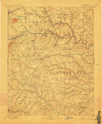
~ Spotsylvania VA topo map, 1:125000 scale, 30 X 30 Minute, Historical, 1892, updated 1912
Spotsylvania, Virginia, USGS topographic map dated 1892.
Includes geographic coordinates (latitude and longitude). This topographic map is suitable for hiking, camping, and exploring, or framing it as a wall map.
Printed on-demand using high resolution imagery, on heavy weight and acid free paper, or alternatively on a variety of synthetic materials.
Topos available on paper, Waterproof, Poly, or Tyvek. Usually shipping rolled, unless combined with other folded maps in one order.
- Product Number: USGS-5304100
- Free digital map download (high-resolution, GeoPDF): Spotsylvania, Virginia (file size: 7 MB)
- Map Size: please refer to the dimensions of the GeoPDF map above
- Weight (paper map): ca. 55 grams
- Map Type: POD USGS Topographic Map
- Map Series: HTMC
- Map Verison: Historical
- Cell ID: 66673
- Scan ID: 189172
- Imprint Year: 1912
- Survey Year: 1887
- Datum: Unstated
- Map Projection: Unstated
- Map published by United States Geological Survey
- Map Language: English
- Scanner Resolution: 600 dpi
- Map Cell Name: Spotsylvania
- Grid size: 30 X 30 Minute
- Date on map: 1892
- Map Scale: 1:125000
- Geographical region: Virginia, United States
Neighboring Maps:
All neighboring USGS topo maps are available for sale online at a variety of scales.
Spatial coverage:
Topo map Spotsylvania, Virginia, covers the geographical area associated the following places:
- Stubbs - Silver Hill - Hartwood - Milburn Estates - Kimberly Estates - Mars Mobile Home Park - Winfrey - Cropp Road Estates - Ashburn Hills - Concord Estates - Tacketts Farm - Kings Grant - Foxwood Estates - Rose Hill Farms - Lagrange - Cardinal Forest - Red Hill - Crestwood - Old Banks - Holly Corner Estates - Ladysmith - Deep Run - Bend (historical) - Hazel Grove - Gauntlet Estates - Berea Estates - Indian Town - Stonehouse Wooded Estates - Nora Park - Hams Ford - Holladay - Belle Parc - Old Trap - Water Edge Estates - Georgetown West - Roseville Heights - Ellisville - Panier - Royal Hills Estates - Richardsville South - Mount Pleasant - Shackelford Estates - Peach Lawn - Marye - Greens Corner - Mount Holly - Stefaniga - Rosewood Estates - Lakeland Forest - Centreville - Cannon Knolls - Arcadia - Todds Tavern - Lignum - Christy Farm - Eagles Nest - Scenic Ridge - England Run - Dan - Unionville - Harwill Acres - Ann Wrights Corner - Valhalla - Vulcan - Partlow - Logan - Barrington Woods - Windsor Forest - Penneys Crossroad - Richardsville - Snead Estates - Rosedale - High Point - Kirk O'Cliff - Margo - Whitestone - Dodds Corner - Ribbon - The Willows - Lanes Corner - Levy - Massaponax - Chesterwood - Cedar Knolls Estates - Monrovia - Ryland Corner - Wallaces Corner - The Preserve on Aquia Creek - Smiths Mill - Chancellorsville - Mansfield Manor - Warrenton Center - Long Branch - Holly Corners - Glendie - Seymour Knolls - Hartwood Village - Hampshire Forest - Whitetown - Monroe Estates
- Map Area ID: AREA38.538-78-77.5
- Northwest corner Lat/Long code: USGSNW38.5-78
- Northeast corner Lat/Long code: USGSNE38.5-77.5
- Southwest corner Lat/Long code: USGSSW38-78
- Southeast corner Lat/Long code: USGSSE38-77.5
- Northern map edge Latitude: 38.5
- Southern map edge Latitude: 38
- Western map edge Longitude: -78
- Eastern map edge Longitude: -77.5


