
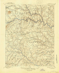
~ Spotsylvania VA topo map, 1:125000 scale, 30 X 30 Minute, Historical, 1892, updated 1944
Spotsylvania, Virginia, USGS topographic map dated 1892.
Includes geographic coordinates (latitude and longitude). This topographic map is suitable for hiking, camping, and exploring, or framing it as a wall map.
Printed on-demand using high resolution imagery, on heavy weight and acid free paper, or alternatively on a variety of synthetic materials.
Topos available on paper, Waterproof, Poly, or Tyvek. Usually shipping rolled, unless combined with other folded maps in one order.
- Product Number: USGS-5304098
- Free digital map download (high-resolution, GeoPDF): Spotsylvania, Virginia (file size: 7 MB)
- Map Size: please refer to the dimensions of the GeoPDF map above
- Weight (paper map): ca. 55 grams
- Map Type: POD USGS Topographic Map
- Map Series: HTMC
- Map Verison: Historical
- Cell ID: 66673
- Scan ID: 189166
- Imprint Year: 1944
- Survey Year: 1887
- Datum: Unstated
- Map Projection: Polyconic
- Map published by United States Geological Survey
- Map Language: English
- Scanner Resolution: 600 dpi
- Map Cell Name: Spotsylvania
- Grid size: 30 X 30 Minute
- Date on map: 1892
- Map Scale: 1:125000
- Geographical region: Virginia, United States
Neighboring Maps:
All neighboring USGS topo maps are available for sale online at a variety of scales.
Spatial coverage:
Topo map Spotsylvania, Virginia, covers the geographical area associated the following places:
- Woodridge - Bells Crossroad - Monroe Estates - Richland Forest - Monrovia - Kimberly Estates - Willowmere - Wallaces Corner - Berea Estates - Hartwood Meadows - Ashburn Hills - Wares Crossroads - Royal Hills Estates - Hartwood Village - Tatum - Wilderness - Concord - Meadows of Culpeper - Milburn Estates - Holly Run Estates - Raccoon Ford - Old Trap - Tacketts Farm - Sherwood Estates - Greens Corner - Shady Grove Corner - Harwill Acres - The Preserve on Aquia Creek - Mansfield (historical) - Brandy Hills - Stonehouse Wooded Estates - Partlow - Sherwood Forest - Richardsville - High Point - Warrenton Center - Granite Springs - Whitestone - Wilderness Corner - Roseville - English Hills - Majestic Ridge Estates - Leavells - Marsh Run Estates - Thornburg - Danton - Penneys Crossroad - Cypress Estates - White Owl Landing - Holly Corner - Walden Ten - Levy - Laurelwood - Gold Dale - Gatewood - Davis Corner - Berry Hill Estates - Gauntlet Estates - Barrington Woods - Hoys Way - Golden Hills - Vulcan - Paytes - Georgetown West - Porters - Kellys Ford - Indian Town - Mastins Corner - Cropp Road Estates - Olivers Corner - Wellington Chase on the Rappahannock - England Run - Winfrey - Ellisville - Heflin - Ann Wrights Corner - Maple Grove Estates - Nora Park - Frank Martin Farms - The Estates - Crestwood - Silver Hill - Holly Corner Estates - Amsonia - Whitetown - Pine View - Massaponax - Nellie Estates - Carrera Estates - Braggs Corner - Quiet Woods Estate - The Blake Farm - Walnut Grove - Waverly Village - Brokenburg - Lignum - Eagles Nest - Christy Farm - Panier - Crown Manor
- Map Area ID: AREA38.538-78-77.5
- Northwest corner Lat/Long code: USGSNW38.5-78
- Northeast corner Lat/Long code: USGSNE38.5-77.5
- Southwest corner Lat/Long code: USGSSW38-78
- Southeast corner Lat/Long code: USGSSE38-77.5
- Northern map edge Latitude: 38.5
- Southern map edge Latitude: 38
- Western map edge Longitude: -78
- Eastern map edge Longitude: -77.5


