
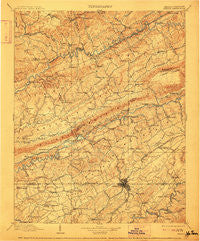
~ Bristol VA topo map, 1:125000 scale, 30 X 30 Minute, Historical, 1902, updated 1912
Bristol, Virginia, USGS topographic map dated 1902.
Includes geographic coordinates (latitude and longitude). This topographic map is suitable for hiking, camping, and exploring, or framing it as a wall map.
Printed on-demand using high resolution imagery, on heavy weight and acid free paper, or alternatively on a variety of synthetic materials.
Topos available on paper, Waterproof, Poly, or Tyvek. Usually shipping rolled, unless combined with other folded maps in one order.
- Product Number: USGS-5303762
- Free digital map download (high-resolution, GeoPDF): Bristol, Virginia (file size: 9 MB)
- Map Size: please refer to the dimensions of the GeoPDF map above
- Weight (paper map): ca. 55 grams
- Map Type: POD USGS Topographic Map
- Map Series: HTMC
- Map Verison: Historical
- Cell ID: 65058
- Scan ID: 188867
- Imprint Year: 1912
- Survey Year: 1895
- Datum: Unstated
- Map Projection: Unstated
- Map published by United States Geological Survey
- Map Language: English
- Scanner Resolution: 600 dpi
- Map Cell Name: Bristol
- Grid size: 30 X 30 Minute
- Date on map: 1902
- Map Scale: 1:125000
- Geographical region: Virginia, United States
Neighboring Maps:
All neighboring USGS topo maps are available for sale online at a variety of scales.
Spatial coverage:
Topo map Bristol, Virginia, covers the geographical area associated the following places:
- Woodrow - Brumley Gap - Virginia Heights - Burson Place - Clinchfield - Emmett - Hilander Park - Grizzle (historical) - Big Creek (historical) - Grandview Terrace - Stringtown - Fall Creek - Banners Corner - Oak Hill - Greendale - Banner - Cantrell (historical) - Cedar Valley - Crab Orchard - Redstone - Fair Acres - Pine (historical) - Sunny Brook - Saint Paul - Edgefield - Point Truth - Akard Addition - Colonial Heights - Counts - Grigbys Store - Arcadia - Lake Park - Temple Hill - Oak Grove - Painter Spring - West Dante - Dry Fork - Pine Grove - Goose Pimple Junction - Coeburn - Springdale - Larwood - Silica - Hemlock - Herald - Ketrontown - Fulkerson - Beidlemans (historical) - Briarwood - Maces Spring - Lonesome (historical) - Craigs Mill - Mystic Valley - Stony - Grassy Creek - Dorado - Willis - Hawkins Mill - Bolton - Wallace - Gray Acres - Morefield - Mill Point - Bruno - Huddle Mill - Bristol - Rock City - Ridgefield - Pullontown - Trammel (historical) - McChesney Heights - Candler - Crackers Neck - Hunter Hills - Barytes - Valley Hills - Hill Country - Virginia Hills - Springdale - Fleenor Spring - Shelleys - Rush Corner - Booker - Roebuck - Candlewyck - Fairmount - Zenobia - Johnson Court - John - Virginia City - Three Springs - Stonegate - Mount Area Estates - McConnell - Camp Placid - High Meadows - Windy Hill - McConnell Mill - Kingtown - Preston Hills
- Map Area ID: AREA3736.5-82.5-82
- Northwest corner Lat/Long code: USGSNW37-82.5
- Northeast corner Lat/Long code: USGSNE37-82
- Southwest corner Lat/Long code: USGSSW36.5-82.5
- Southeast corner Lat/Long code: USGSSE36.5-82
- Northern map edge Latitude: 37
- Southern map edge Latitude: 36.5
- Western map edge Longitude: -82.5
- Eastern map edge Longitude: -82


