
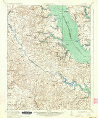
~ Urbanna VA topo map, 1:62500 scale, 15 X 15 Minute, Historical, 1917, updated 1934
Urbanna, Virginia, USGS topographic map dated 1917.
Includes geographic coordinates (latitude and longitude). This topographic map is suitable for hiking, camping, and exploring, or framing it as a wall map.
Printed on-demand using high resolution imagery, on heavy weight and acid free paper, or alternatively on a variety of synthetic materials.
Topos available on paper, Waterproof, Poly, or Tyvek. Usually shipping rolled, unless combined with other folded maps in one order.
- Product Number: USGS-5303498
- Free digital map download (high-resolution, GeoPDF): Urbanna, Virginia (file size: 8 MB)
- Map Size: please refer to the dimensions of the GeoPDF map above
- Weight (paper map): ca. 55 grams
- Map Type: POD USGS Topographic Map
- Map Series: HTMC
- Map Verison: Historical
- Cell ID: 63945
- Scan ID: 188657
- Imprint Year: 1934
- Survey Year: 1916
- Datum: NAD
- Map Projection: Polyconic
- Map published by United States Army Corps of Engineers
- Map published by United States Department of War
- Map Language: English
- Scanner Resolution: 600 dpi
- Map Cell Name: Urbanna
- Grid size: 15 X 15 Minute
- Date on map: 1917
- Map Scale: 1:62500
- Geographical region: Virginia, United States
Neighboring Maps:
All neighboring USGS topo maps are available for sale online at a variety of scales.
Spatial coverage:
Topo map Urbanna, Virginia, covers the geographical area associated the following places:
- Pine Tree - Locust Hill - Snow Hill - Clancie - Jamaica - Stormont - Samos - Warner - Revis - Cologne - Church View - Glenns - Shacklefords - Water View - Mollusk - Bertrand - Hockley - Urbanna - Owl Trap - Harcum - Dutton (historical) - Mascot - Christchurch - Shacklefords Fork - Senora - Velma - Pampa - New Upton - Saluda - Hornets Nest - Nesting - Batt - Farley Park Corner - Cooks Corner - Coldwater - Beulahland - Mount Zion - Remlik - Monaskon - Greenvale (historical) - Healys - Ottoman - Cooper - Freeport
- Map Area ID: AREA37.7537.5-76.75-76.5
- Northwest corner Lat/Long code: USGSNW37.75-76.75
- Northeast corner Lat/Long code: USGSNE37.75-76.5
- Southwest corner Lat/Long code: USGSSW37.5-76.75
- Southeast corner Lat/Long code: USGSSE37.5-76.5
- Northern map edge Latitude: 37.75
- Southern map edge Latitude: 37.5
- Western map edge Longitude: -76.75
- Eastern map edge Longitude: -76.5


