
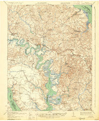
~ Toano VA topo map, 1:62500 scale, 15 X 15 Minute, Historical, 1918, updated 1930
Toano, Virginia, USGS topographic map dated 1918.
Includes geographic coordinates (latitude and longitude). This topographic map is suitable for hiking, camping, and exploring, or framing it as a wall map.
Printed on-demand using high resolution imagery, on heavy weight and acid free paper, or alternatively on a variety of synthetic materials.
Topos available on paper, Waterproof, Poly, or Tyvek. Usually shipping rolled, unless combined with other folded maps in one order.
- Product Number: USGS-5303486
- Free digital map download (high-resolution, GeoPDF): Toano, Virginia (file size: 8 MB)
- Map Size: please refer to the dimensions of the GeoPDF map above
- Weight (paper map): ca. 55 grams
- Map Type: POD USGS Topographic Map
- Map Series: HTMC
- Map Verison: Historical
- Cell ID: 63592
- Scan ID: 188645
- Imprint Year: 1930
- Survey Year: 1917
- Datum: NAD
- Map Projection: Polyconic
- Map published by United States Army Corps of Engineers
- Map published by United States Department of War
- Map Language: English
- Scanner Resolution: 600 dpi
- Map Cell Name: Toano
- Grid size: 15 X 15 Minute
- Date on map: 1918
- Map Scale: 1:62500
- Geographical region: Virginia, United States
Neighboring Maps:
All neighboring USGS topo maps are available for sale online at a variety of scales.
Spatial coverage:
Topo map Toano, Virginia, covers the geographical area associated the following places:
- Diascund - Holly Forks - Toano - Powhatan Secondary - Forest Glen - Mobile Estates - Powhatan of Williamsburg - Croaker - Lake Toano Estates - Heritage Landing - Mount Airy - Toano Trace - Kristiansand - Chickahominy Haven - The Foxes - Heath Trailer Park - Claybank Landing - Powhatan Plantation - Steeple Chase - Kings Corner - Holdcroft - Farmville Estates - Lanexa - Norge - The Meadows - Norge Court - Blanks Store - Seasons Trace - Camelot - Hunters Creek - Osborn Landing - Greensprings Mobile Home Park - Chickahominy Shores - Rustic - Lower Brandon - Warren Mill - Walkers - Centerville - Springhill - Middle Plantation - Powhatan Crossing - Oakland - Burton Woods - Andersons Corner - Brandon - Lightfoot - Barhamsville - Windsor Forest - Five Forks - Deerwood Hills - Fords Colony - James Shire Settlement - Bock (historical) - Longhill Gate - Fieldcrest - Lafayette Square - Kennon - Adams Hunt - Brickyard Landing - Marstons Mobile Home Park - Williamsburg West - The Links - Chestnut Hill - The Row - Fox Ridge - Slaterville - Baron Woods
- Map Area ID: AREA37.537.25-77-76.75
- Northwest corner Lat/Long code: USGSNW37.5-77
- Northeast corner Lat/Long code: USGSNE37.5-76.75
- Southwest corner Lat/Long code: USGSSW37.25-77
- Southeast corner Lat/Long code: USGSSE37.25-76.75
- Northern map edge Latitude: 37.5
- Southern map edge Latitude: 37.25
- Western map edge Longitude: -77
- Eastern map edge Longitude: -76.75


