
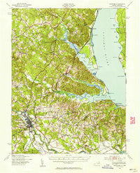
~ Stafford VA topo map, 1:62500 scale, 15 X 15 Minute, Historical, 1926, updated 1956
Stafford, Virginia, USGS topographic map dated 1926.
Includes geographic coordinates (latitude and longitude). This topographic map is suitable for hiking, camping, and exploring, or framing it as a wall map.
Printed on-demand using high resolution imagery, on heavy weight and acid free paper, or alternatively on a variety of synthetic materials.
Topos available on paper, Waterproof, Poly, or Tyvek. Usually shipping rolled, unless combined with other folded maps in one order.
- Product Number: USGS-5303414
- Free digital map download (high-resolution, GeoPDF): Stafford, Virginia (file size: 8 MB)
- Map Size: please refer to the dimensions of the GeoPDF map above
- Weight (paper map): ca. 55 grams
- Map Type: POD USGS Topographic Map
- Map Series: HTMC
- Map Verison: Historical
- Cell ID: 62900
- Scan ID: 188590
- Imprint Year: 1956
- Woodland Tint: Yes
- Survey Year: 1926
- Datum: NAD27
- Map Projection: Polyconic
- Map published by United States Army Corps of Engineers
- Map Language: English
- Scanner Resolution: 600 dpi
- Map Cell Name: Stafford
- Grid size: 15 X 15 Minute
- Date on map: 1926
- Map Scale: 1:62500
- Geographical region: Virginia, United States
Neighboring Maps:
All neighboring USGS topo maps are available for sale online at a variety of scales.
Spatial coverage:
Topo map Stafford, Virginia, covers the geographical area associated the following places:
- The Hills of Potomac Creek - Cedar Bluff - Brentwood Estates - Daffan - Johnsons Corner - Bexley Manor - Sandy Ridge - Raspberry - Stratford Place - Fall Run Park - Heritage Commons - Fritters Corner - Fitzhugh - Ferry Farm - Cobblestone - Howes Bluff - Kendallwood East - Woodmont - Highpointe - Barrett Heights - Elizabeth Park - Aquia Bay Estates - Fourmile Fork - Phillips - The Falls - Lynwood - Brookstone - Graninger Mobile Home Park - Aquia Inlet Estates - Aquia - Shea Estates - North Clearview Heights - Lambs Creek - Bayview Estates - Basil Gordon - Falmouth Heights - Canterbury Village - Aquia Harbour - Colbert Walker Estates - Liverpool Wharf - Goby - Glenwood Forest - Falmouth Village - Jessica Estates - Meadowbrook Estates - Poplar Hills - Mayfield - Little Falls - Chatam - Grace Shelton Family Subdivision - Sky Terrace - Potomac Overlook - Widewater - The Holly Woods - Belle Oaks - Smith Lake Landing - Highland Homes - Chatham Village - Bourne - Bowers - Canterbury Estates - Bald Eagle Hills - Wallace Farms - Cottage Green - Deacon Road Estates - Fredericksburg - The Oaks at Ferry Farm - Decatur (historical) - Briarwood Estates - Moores Corner - Garrisonville - Apple Grove - Groves Estates - Cranewood - Cannon Ridge - Georgetown East - Autumn Ridge - Aquia Creek - E O Brooks Subdivision - Will Morgan Farm - Stafford Heights - Kendallwood Estates - Potomac Hills - Locklears Knoll - Hart Division of Little Falls - Freedom Estates - Mount Pleasant Estates - Rolling Meadows - Fairview and Oakland - Argyle Hills - Upper Redoubt Heights - Arbor Glen - River Heights - Ferry Road - Fines Corner - Stafford Oaks - Kings Crest - Brafferton - Jefferson Place - Locklears Landing
- Map Area ID: AREA38.538.25-77.5-77.25
- Northwest corner Lat/Long code: USGSNW38.5-77.5
- Northeast corner Lat/Long code: USGSNE38.5-77.25
- Southwest corner Lat/Long code: USGSSW38.25-77.5
- Southeast corner Lat/Long code: USGSSE38.25-77.25
- Northern map edge Latitude: 38.5
- Southern map edge Latitude: 38.25
- Western map edge Longitude: -77.5
- Eastern map edge Longitude: -77.25


