
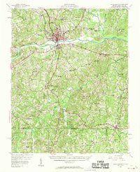
~ South Boston VA topo map, 1:62500 scale, 15 X 15 Minute, Historical, 1957, updated 1958
South Boston, Virginia, USGS topographic map dated 1957.
Includes geographic coordinates (latitude and longitude). This topographic map is suitable for hiking, camping, and exploring, or framing it as a wall map.
Printed on-demand using high resolution imagery, on heavy weight and acid free paper, or alternatively on a variety of synthetic materials.
Topos available on paper, Waterproof, Poly, or Tyvek. Usually shipping rolled, unless combined with other folded maps in one order.
- Product Number: USGS-5303396
- Free digital map download (high-resolution, GeoPDF): South Boston, Virginia (file size: 9 MB)
- Map Size: please refer to the dimensions of the GeoPDF map above
- Weight (paper map): ca. 55 grams
- Map Type: POD USGS Topographic Map
- Map Series: HTMC
- Map Verison: Historical
- Cell ID: 62783
- Scan ID: 188577
- Imprint Year: 1958
- Woodland Tint: Yes
- Visual Version Number: 2
- Aerial Photo Year: 1948
- Field Check Year: 1957
- Datum: NAD27
- Map Projection: Polyconic
- Map published by United States Geological Survey
- Map Language: English
- Scanner Resolution: 600 dpi
- Map Cell Name: South Boston
- Grid size: 15 X 15 Minute
- Date on map: 1957
- Map Scale: 1:62500
- Geographical region: Virginia, United States
Neighboring Maps:
All neighboring USGS topo maps are available for sale online at a variety of scales.
Spatial coverage:
Topo map South Boston, Virginia, covers the geographical area associated the following places:
- Moffett - Five Forks - Wolf Trap - Cluster Springs - Marsailles (historical) - Woodlawn Park - Virgilina - Fordland Estates - Sinai - Oak Hill Estates - Riverdale - Westside Village - Cedar Grove - Bethel Hill - Centerville - Harmony - Mayo - Centerville - Omega - Red Bank - Hyco - Christie - Highland Hills - Denniston - Shady Grove - Rogersville - South Boston
- Map Area ID: AREA36.7536.5-79-78.75
- Northwest corner Lat/Long code: USGSNW36.75-79
- Northeast corner Lat/Long code: USGSNE36.75-78.75
- Southwest corner Lat/Long code: USGSSW36.5-79
- Southeast corner Lat/Long code: USGSSE36.5-78.75
- Northern map edge Latitude: 36.75
- Southern map edge Latitude: 36.5
- Western map edge Longitude: -79
- Eastern map edge Longitude: -78.75


