
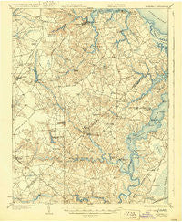
~ Smithfield VA topo map, 1:62500 scale, 15 X 15 Minute, Historical, 1919, updated 1929
Smithfield, Virginia, USGS topographic map dated 1919.
Includes geographic coordinates (latitude and longitude). This topographic map is suitable for hiking, camping, and exploring, or framing it as a wall map.
Printed on-demand using high resolution imagery, on heavy weight and acid free paper, or alternatively on a variety of synthetic materials.
Topos available on paper, Waterproof, Poly, or Tyvek. Usually shipping rolled, unless combined with other folded maps in one order.
- Product Number: USGS-5303386
- Free digital map download (high-resolution, GeoPDF): Smithfield, Virginia (file size: 8 MB)
- Map Size: please refer to the dimensions of the GeoPDF map above
- Weight (paper map): ca. 55 grams
- Map Type: POD USGS Topographic Map
- Map Series: HTMC
- Map Verison: Historical
- Cell ID: 62702
- Scan ID: 188570
- Imprint Year: 1929
- Survey Year: 1918
- Datum: NAD
- Map Projection: Polyconic
- Map published by United States Army Corps of Engineers
- Map published by United States Department of War
- Map Language: English
- Scanner Resolution: 600 dpi
- Map Cell Name: Smithfield
- Grid size: 15 X 15 Minute
- Date on map: 1919
- Map Scale: 1:62500
- Geographical region: Virginia, United States
Neighboring Maps:
All neighboring USGS topo maps are available for sale online at a variety of scales.
Spatial coverage:
Topo map Smithfield, Virginia, covers the geographical area associated the following places:
- Central Hill - Cedar Crest Hall - Sleepy Lake West - Lone Star Lakes - Rollingwood - Isle of Wight Mobile Home Village - Kingsdale - Willowbrook - Kings Crossing - Foursquare - Blairs Creek Mobile Home Park - Russell Point - Cedar Lake Shores - Providence Church - Sadler Heights - Carisbrooke - Windsor - Lake Forest - Bennett Harbor - Lake Meade Point - Driver - Twin Ponds Mobile Home Park - Palmyra - Wilkerson Landing - Myrtle - Lake Prince Meadows - Beamon - Horseshoe Point - Hobson - Oakland - Sleepy Lake - Bennett Corner - Outlaw Mobile Home Park - Sleepy Point Estates - Berkshire Meadows - Red Oaks Mobile Community - Princeview Point - Everets - Jones Creek Landing Mobile Home Park - Lake Prince Farms - Comet - Acorn Acres - Wills Corner - Bayview - Indian Point Estates - Kings Point - Sandy Bottom - North Gate - Smithfield - Nansemond - Lakeside Manufactured Home Community - Point Harbor - Magnolia Lakes Mobile Home Park - Benns Church - Isle of Wight - Kings Fork - Wilroy - Battery Park - Carrollton Estates - Elephant Fork - Rivercliff - Idlewood - Constances Warehouse (historical) - Barlett - Rescue - Baileytown - Carrollton - Cherry Grove Estates - Booker T Estates - Indika - Gloversville - Bethel Church - Longview - Windsor Manor Mobile Home Park - Thompson Landing - Magnet - Muddy Cross - Bridge Point Farms - Longvue Shores - Brittany Farms - Chuckatuck - Red Top
- Map Area ID: AREA3736.75-76.75-76.5
- Northwest corner Lat/Long code: USGSNW37-76.75
- Northeast corner Lat/Long code: USGSNE37-76.5
- Southwest corner Lat/Long code: USGSSW36.75-76.75
- Southeast corner Lat/Long code: USGSSE36.75-76.5
- Northern map edge Latitude: 37
- Southern map edge Latitude: 36.75
- Western map edge Longitude: -76.75
- Eastern map edge Longitude: -76.5


