
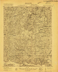
~ White Plains VA topo map, 1:48000 scale, 15 X 15 Minute, Historical, 1919
White Plains, Virginia, USGS topographic map dated 1919.
Includes geographic coordinates (latitude and longitude). This topographic map is suitable for hiking, camping, and exploring, or framing it as a wall map.
Printed on-demand using high resolution imagery, on heavy weight and acid free paper, or alternatively on a variety of synthetic materials.
Topos available on paper, Waterproof, Poly, or Tyvek. Usually shipping rolled, unless combined with other folded maps in one order.
- Product Number: USGS-5302524
- Free digital map download (high-resolution, GeoPDF): White Plains, Virginia (file size: 15 MB)
- Map Size: please refer to the dimensions of the GeoPDF map above
- Weight (paper map): ca. 55 grams
- Map Type: POD USGS Topographic Map
- Map Series: HTMC
- Map Verison: Historical
- Cell ID: 64484
- Scan ID: 187761
- Survey Year: 1919
- Datum: Unstated
- Map Projection: Unstated
- Advance: Yes
- Map published by United States Army Corps of Engineers
- Map published by United States Department of War
- Keywords: Nonstandard Press Run
- Map Language: English
- Scanner Resolution: 600 dpi
- Map Cell Name: White Plains
- Grid size: 15 X 15 Minute
- Date on map: 1919
- Map Scale: 1:48000
- Geographical region: Virginia, United States
Neighboring Maps:
All neighboring USGS topo maps are available for sale online at a variety of scales.
Spatial coverage:
Topo map White Plains, Virginia, covers the geographical area associated the following places:
- Bowers Corner - Old Fitzhugh - Poythress Estates - Vineland (historical) - Hidden Acres - Valentines - Greentown - Pea Hill Estates - Ebony - Henrico - Revistown (historical) - Watkins Corner - Brunswick - Vultare - White Plains - Delbridge Estates - Fitzhugh - Diamond Grove - Netta (historical) - Fort Christanna - Triplet - Colony Club - Ezell - Lawrenceville Hills - Hicks Mill - Powellton - Southside Shores - Brunswick Estates - Drumgoole (historical) - Lake Gaston Estates - Ankum - Elams - Gholsonville - Kennons (historical) - Merchant - Pea Hill Shores - Gasburg - Bowens Corner - Wyche
- Map Area ID: AREA36.7536.5-78-77.75
- Northwest corner Lat/Long code: USGSNW36.75-78
- Northeast corner Lat/Long code: USGSNE36.75-77.75
- Southwest corner Lat/Long code: USGSSW36.5-78
- Southeast corner Lat/Long code: USGSSE36.5-77.75
- Northern map edge Latitude: 36.75
- Southern map edge Latitude: 36.5
- Western map edge Longitude: -78
- Eastern map edge Longitude: -77.75


