
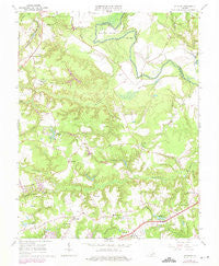
~ Studley VA topo map, 1:24000 scale, 7.5 X 7.5 Minute, Historical, 1964, updated 1975
Studley, Virginia, USGS topographic map dated 1964.
Includes geographic coordinates (latitude and longitude). This topographic map is suitable for hiking, camping, and exploring, or framing it as a wall map.
Printed on-demand using high resolution imagery, on heavy weight and acid free paper, or alternatively on a variety of synthetic materials.
Topos available on paper, Waterproof, Poly, or Tyvek. Usually shipping rolled, unless combined with other folded maps in one order.
- Product Number: USGS-5301370
- Free digital map download (high-resolution, GeoPDF): Studley, Virginia (file size: 10 MB)
- Map Size: please refer to the dimensions of the GeoPDF map above
- Weight (paper map): ca. 55 grams
- Map Type: POD USGS Topographic Map
- Map Series: HTMC
- Map Verison: Historical
- Cell ID: 43550
- Scan ID: 186869
- Imprint Year: 1975
- Woodland Tint: Yes
- Photo Revision Year: 1974
- Aerial Photo Year: 1974
- Field Check Year: 1964
- Datum: NAD27
- Map Projection: Polyconic
- Map published by United States Geological Survey
- Map Language: English
- Scanner Resolution: 600 dpi
- Map Cell Name: Studley
- Grid size: 7.5 X 7.5 Minute
- Date on map: 1964
- Map Scale: 1:24000
- Geographical region: Virginia, United States
Neighboring Maps:
All neighboring USGS topo maps are available for sale online at a variety of scales.
Spatial coverage:
Topo map Studley, Virginia, covers the geographical area associated the following places:
- Greenway - Pole Green - Cady - Pebblebrook - Raven Run - Hughes Corner - The Colonies - Orchard Gardens - Robin Ridge - Studley Farms - Buckeye - Newman - Guilds Acres - Pamunkey Estates - Benthill - Locust Green - Pine Hill - Cherrydale West - Rainier Estates - Battlefield Green - Cherrydale - Mattawan - Heatherwood - Meadow Gate - Swannanoa Estates - Hundleys Corner - Shannondale Estates - Studley - Colonial Forest - Oak Forest - Bell Creek North - Hilly Farms - Crosses Corner - Strawhorn - Fieldshire - Avondale - Georgetown
- Map Area ID: AREA37.7537.625-77.375-77.25
- Northwest corner Lat/Long code: USGSNW37.75-77.375
- Northeast corner Lat/Long code: USGSNE37.75-77.25
- Southwest corner Lat/Long code: USGSSW37.625-77.375
- Southeast corner Lat/Long code: USGSSE37.625-77.25
- Northern map edge Latitude: 37.75
- Southern map edge Latitude: 37.625
- Western map edge Longitude: -77.375
- Eastern map edge Longitude: -77.25


