
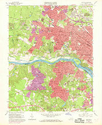
~ Bon Air VA topo map, 1:24000 scale, 7.5 X 7.5 Minute, Historical, 1964, updated 1969
Bon Air, Virginia, USGS topographic map dated 1964.
Includes geographic coordinates (latitude and longitude). This topographic map is suitable for hiking, camping, and exploring, or framing it as a wall map.
Printed on-demand using high resolution imagery, on heavy weight and acid free paper, or alternatively on a variety of synthetic materials.
Topos available on paper, Waterproof, Poly, or Tyvek. Usually shipping rolled, unless combined with other folded maps in one order.
- Product Number: USGS-5296663
- Free digital map download (high-resolution, GeoPDF): Bon Air, Virginia (file size: 14 MB)
- Map Size: please refer to the dimensions of the GeoPDF map above
- Weight (paper map): ca. 55 grams
- Map Type: POD USGS Topographic Map
- Map Series: HTMC
- Map Verison: Historical
- Cell ID: 4759
- Scan ID: 184169
- Imprint Year: 1969
- Woodland Tint: Yes
- Photo Revision Year: 1968
- Aerial Photo Year: 1968
- Field Check Year: 1964
- Datum: NAD27
- Map Projection: Polyconic
- Map published by United States Geological Survey
- Map Language: English
- Scanner Resolution: 600 dpi
- Map Cell Name: Bon Air
- Grid size: 7.5 X 7.5 Minute
- Date on map: 1964
- Map Scale: 1:24000
- Geographical region: Virginia, United States
Neighboring Maps:
All neighboring USGS topo maps are available for sale online at a variety of scales.
Spatial coverage:
Topo map Bon Air, Virginia, covers the geographical area associated the following places:
- Sheffield Court - Mooreland - Mooreland Farms - Holiday Hills - Dorset Woods - Tuckahoe Village - Gravel Hill - Wedgewood - Quioccasin - Westlake Hills - Twin Valley Farms - Nottingham - Chesterfield Village - Gayton - Beaufort Estates - Chippenham Village - Highland Hills - Westhampton - Brookwood Estates - Fernleigh - Crestview - Fairway Acres - Forest Hill Farms - Rio Vista - Westchester - Pittaway Farms - Glenbrook Hills - Cherokee Hills - Staffordshire - Tinsleys - Robious - Southampton - Granite - Canterbury - Willow Oaks - Glen Echo Place - Bon Air - Ramsgate - Sweet Briar Park - Drouin Hill - Huguenot Farms - Old Gun - Tuckahoe - River Road Hills - Spring Grove - Beaufont Hills - Ziontown - Southhampton Hills - Bosher - Roslyn Hills - Cambridge - Hobby Hill Farms - Westover Heights - Westover Gardens - Crestwood Farms - Bon Air Manor - Woodmont - Westham - Wayland - Lorraine - Grand Summit - Westbriar - Stratford Hills - Brighton Green - Pinehurts - Oxford - Buford Estates - Mount Nebo
- Map Area ID: AREA37.62537.5-77.625-77.5
- Northwest corner Lat/Long code: USGSNW37.625-77.625
- Northeast corner Lat/Long code: USGSNE37.625-77.5
- Southwest corner Lat/Long code: USGSSW37.5-77.625
- Southeast corner Lat/Long code: USGSSE37.5-77.5
- Northern map edge Latitude: 37.625
- Southern map edge Latitude: 37.5
- Western map edge Longitude: -77.625
- Eastern map edge Longitude: -77.5


