
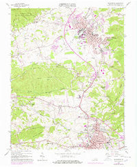
~ Blacksburg VA topo map, 1:24000 scale, 7.5 X 7.5 Minute, Historical, 1965, updated 1978
Blacksburg, Virginia, USGS topographic map dated 1965.
Includes geographic coordinates (latitude and longitude). This topographic map is suitable for hiking, camping, and exploring, or framing it as a wall map.
Printed on-demand using high resolution imagery, on heavy weight and acid free paper, or alternatively on a variety of synthetic materials.
Topos available on paper, Waterproof, Poly, or Tyvek. Usually shipping rolled, unless combined with other folded maps in one order.
- Product Number: USGS-5296603
- Free digital map download (high-resolution, GeoPDF): Blacksburg, Virginia (file size: 12 MB)
- Map Size: please refer to the dimensions of the GeoPDF map above
- Weight (paper map): ca. 55 grams
- Map Type: POD USGS Topographic Map
- Map Series: HTMC
- Map Verison: Historical
- Cell ID: 4242
- Scan ID: 184138
- Imprint Year: 1978
- Woodland Tint: Yes
- Photo Revision Year: 1978
- Aerial Photo Year: 1977
- Edit Year: 1978
- Field Check Year: 1965
- Datum: NAD27
- Map Projection: Polyconic
- Map published by United States Geological Survey
- Map Language: English
- Scanner Resolution: 600 dpi
- Map Cell Name: Blacksburg
- Grid size: 7.5 X 7.5 Minute
- Date on map: 1965
- Map Scale: 1:24000
- Geographical region: Virginia, United States
Neighboring Maps:
All neighboring USGS topo maps are available for sale online at a variety of scales.
Spatial coverage:
Topo map Blacksburg, Virginia, covers the geographical area associated the following places:
- Chowning Place - Victory Heights - Oak Manor - Echo Hills - Blacksburg - Clover Valley - Brumfield Acres - Berryfield - Longview Estates - Carriage Hill - Silver Leaf - Sundance Ridge - Hethwood - Murphy - Vicker Heights - Newcomb Heights - Apperson Park - Brightwood Manor - Dundas Heights - Highland Park - Mountain View Park - Karr Heights - Apple Acres - Hans Meadow - Sherwood Forest - Snidow Heights - Orchard View - East Park Addition - Snidow Heights - Patrick Henry Place - Lee-Hi Court - Oakwood Park - Yellow Sulphur - Nicholas Manor - Piedmont - Sleepy Hollow - Southgate - Country Club Park - Kessler Park - Rainbow Ridge - Craig Mountain - Dunton Addition - Beverly Hills - Forest Hills (historical) - Sundance Village - Suburban Hills - Harmon Forest - Ramble Ridge - Bangs (historical) - Merrimac - University Terrace - La Plateau - Henley Place - Airport Acres - Hubbard Haven - Dickerson - Alleghany Addition - Blackwood - Prices Fork - Hilltop Plaza - Linkous - Evergreen - Blue Ridge Court - Belmont - The Orchard - Westover Hills - Farmview - Carma Heights - Pheasant Run - Kanodes Mill - Pilgrims Pointe - Cedar Orchard - Mission Hills - Raintree Village - Belmont Estates - Knob Hill - The Vistas - Rolling Hills - Shenandoah - Windmill Hills - Silver Lake Heights - Vista Via - Yellow Sulphur Springs - Stonegate - Diamond Pointe - University Place - Crestwood Gardens - Old Farm Village - Tremont Estates - Montgomery Farms - Shelor Acres - Gladewood - McBryde Village - Miller Addition - Lester Place - Woodlyn - Vicker - Midway Heights - Hunters Ridge - Mountain View Estates
- Map Area ID: AREA37.2537.125-80.5-80.375
- Northwest corner Lat/Long code: USGSNW37.25-80.5
- Northeast corner Lat/Long code: USGSNE37.25-80.375
- Southwest corner Lat/Long code: USGSSW37.125-80.5
- Southeast corner Lat/Long code: USGSSE37.125-80.375
- Northern map edge Latitude: 37.25
- Southern map edge Latitude: 37.125
- Western map edge Longitude: -80.5
- Eastern map edge Longitude: -80.375


