
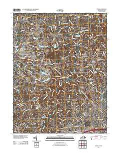
~ Vienna VA topo map, 1:24000 scale, 7.5 X 7.5 Minute, Historical, 2011
Vienna, Virginia, USGS topographic map dated 2011.
Includes geographic coordinates (latitude and longitude). This topographic map is suitable for hiking, camping, and exploring, or framing it as a wall map.
Printed on-demand using high resolution imagery, on heavy weight and acid free paper, or alternatively on a variety of synthetic materials.
Topos available on paper, Waterproof, Poly, or Tyvek. Usually shipping rolled, unless combined with other folded maps in one order.
- Product Number: USGS-5271564
- Free digital map download (high-resolution, GeoPDF): Vienna, Virginia (file size: 27 MB)
- Map Size: please refer to the dimensions of the GeoPDF map above
- Weight (paper map): ca. 55 grams
- Map Type: POD USGS Topographic Map
- Map Series: US Topo
- Map Verison: Historical
- Cell ID: 46908
- Datum: North American Datum of 1983
- Map Projection: Transverse Mercator
- Map Cell Name: Vienna
- Grid size: 7.5 X 7.5 Minute
- Date on map: 2011
- Map Scale: 1:24000
- Geographical region: Virginia, United States
Neighboring Maps:
All neighboring USGS topo maps are available for sale online at a variety of scales.
Spatial coverage:
Topo map Vienna, Virginia, covers the geographical area associated the following places:
- Beau Ridge - A Country Place - Pinecrest - Vienna - Reston - Sun Valley - Oakton - Penderwood - Hunter - Browns Mill - Hickory Creek - Fairview - Great Falls - Hickory Run - Springvale - Vale - Peacock - Sunset Hills - Wolf Trap - Mill Run Acres - Haver Hills - Matildaville (historical) - Kenmore - Old Mill Estates - Four Corners - Shouse Village - Clarks Crossing - Moneys Corner - Spring Ridge - Cinnamon Creek - Lexington Estates - Crowells Corner - Towlston Meadow
- Map Area ID: AREA3938.875-77.375-77.25
- Northwest corner Lat/Long code: USGSNW39-77.375
- Northeast corner Lat/Long code: USGSNE39-77.25
- Southwest corner Lat/Long code: USGSSW38.875-77.375
- Southeast corner Lat/Long code: USGSSE38.875-77.25
- Northern map edge Latitude: 39
- Southern map edge Latitude: 38.875
- Western map edge Longitude: -77.375
- Eastern map edge Longitude: -77.25


