
~ Clay Basin UT topo map, 1:24000 scale, 7.5 X 7.5 Minute, Historical, 2011
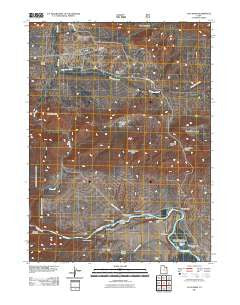
Clay Basin, Utah, USGS topographic map dated 2011.
Includes geographic coordinates (latitude and longitude). This topographic map is suitable for hiking, camping, and exploring, or framing it as a wall map.
Printed on-demand using high resolution imagery, on heavy weight and acid free paper, or alternatively on a variety of synthetic materials.
Topos available on paper, Waterproof, Poly, or Tyvek. Usually shipping rolled, unless combined with other folded maps in one order.
- Product Number: USGS-5252374
- Free digital map download (high-resolution, GeoPDF): Clay Basin, Utah (file size: 26 MB)
- Map Size: please refer to the dimensions of the GeoPDF map above
- Weight (paper map): ca. 55 grams
- Map Type: POD USGS Topographic Map
- Map Series: US Topo
- Map Verison: Historical
- Cell ID: 8986
- Datum: North American Datum of 1983
- Map Projection: Transverse Mercator
- Map Cell Name: Clay Basin
- Grid size: 7.5 X 7.5 Minute
- Date on map: 2011
- Map Scale: 1:24000
- Geographical region: Utah, United States
Neighboring Maps:
All neighboring USGS topo maps are available for sale online at a variety of scales.
Spatial coverage:
Topo map Clay Basin, Utah, covers the geographical area associated the following places:
- Mountain Home Draw - Two Horse Butte - Clay Basin Creek - Beaver Dam Camp - Browns Park National Wildlife Refuge Reservoir - Airstrip Camp - Browns Park National Wildlife Refuge Dam - Browns Park Waterfowl Area - Indian Crossing Raft Ramp - Tolivers Canyon - Martin Draw - Whisky Springs Draw - John Jarvie Ranch (historical) - Taylor Flat Bridge - East Daggett Division - Indian Crossing Campground - Riverside Camp - Red Creek Boat Camp - Scott Canyon - John Jarvie Ranch Historic Site Cemetery - Cottonwood Grove Camp - Tolivers Creek - Mountain Home - Elm Grove Camp - Clay Basin Wildlife Management Area - Clay Basin Camp - Kastler Compressor Station Airport (historical) - Jesse Ewing Canyon - Head of Cottonwood - Band Box Butte - Clay Basin - Browns Park - Fire Flat Camp - Long Bend Camp - Bridge Hollow Picnic Area - Taylors Flat Wildlife Management Area
- Map Area ID: AREA4140.875-109.25-109.125
- Northwest corner Lat/Long code: USGSNW41-109.25
- Northeast corner Lat/Long code: USGSNE41-109.125
- Southwest corner Lat/Long code: USGSSW40.875-109.25
- Southeast corner Lat/Long code: USGSSE40.875-109.125
- Northern map edge Latitude: 41
- Southern map edge Latitude: 40.875
- Western map edge Longitude: -109.25
- Eastern map edge Longitude: -109.125


