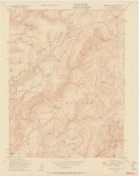
~ American House CA topo map, 1:24000 scale, 7.5 X 7.5 Minute, Historical, 1950
American House, California, USGS topographic map dated 1950.
Includes geographic coordinates (latitude and longitude). This topographic map is suitable for hiking, camping, and exploring, or framing it as a wall map.
Printed on-demand using high resolution imagery, on heavy weight and acid free paper, or alternatively on a variety of synthetic materials.
Topos available on paper, Waterproof, Poly, or Tyvek. Usually shipping rolled, unless combined with other folded maps in one order.
- Product Number: USGS-5507451
- Free digital map download (high-resolution, GeoPDF): American House, California (file size: 11 MB)
- Map Size: please refer to the dimensions of the GeoPDF map above
- Weight (paper map): ca. 55 grams
- Map Type: POD USGS Topographic Map
- Map Series: HTMC
- Map Verison: Historical
- Cell ID: 856
- Scan ID: 302248
- Aerial Photo Year: 1947
- Field Check Year: 1948
- Datum: NAD27
- Map Projection: Polyconic
- Map published by United States Geological Survey
- Map published by United States Bureau of Reclamation
- Map Language: English
- Scanner Resolution: 600 dpi
- Map Cell Name: American House
- Grid size: 7.5 X 7.5 Minute
- Date on map: 1950
- Map Scale: 1:24000
- Geographical region: California, United States
Neighboring Maps:
All neighboring USGS topo maps are available for sale online at a variety of scales.
Spatial coverage:
Topo map American House, California, covers the geographical area associated the following places:
- South Fork Diversion 63-004 Dam - Post Creek - Big Peak Ravine - Bear Creek - Ice Creek - Black Rock Creek - American House Ravine - Davis Creek - American House - McNair Saddle - Willow Creek - Little Grass Valley 63-003 Dam - Big Peak - Harrison Ridge - Lumpkin Ridge - Black Rock Campground - Boehme Ranch - Diamond Springs Hill - Diamond Springs - Little Peak - Little Grass Valley - Valley Creek - McKintosh Ranch - Steward Ravine - Camel Peak - Rocky Creek - Sanborn Mine - Mooreville Ridge - Browns Hill Mine - Diamond Ravine - Lexington Hill - Valley Creek Special Interest Area - Devils Gap - Tamarack Flat
- Map Area ID: AREA39.7539.625-121.125-121
- Northwest corner Lat/Long code: USGSNW39.75-121.125
- Northeast corner Lat/Long code: USGSNE39.75-121
- Southwest corner Lat/Long code: USGSSW39.625-121.125
- Southeast corner Lat/Long code: USGSSE39.625-121
- Northern map edge Latitude: 39.75
- Southern map edge Latitude: 39.625
- Western map edge Longitude: -121.125
- Eastern map edge Longitude: -121