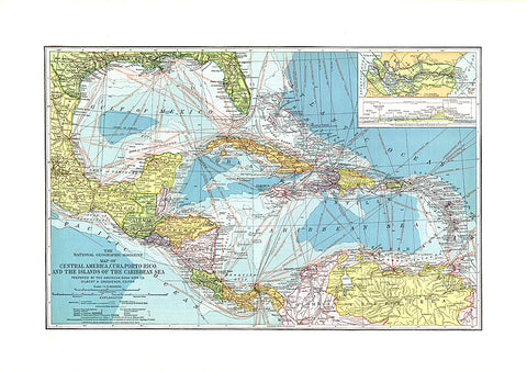
1913 Central America, Cuba, Porto Rico, and the Islands of the Caribbean Sea
This beautiful map of Central America and the Caribbean features ocean bathymetry and colorful county borders, including overlapping colors demonstrating boundaries in dispute. Published in February 1913 one year before the completion of the Panama Canal, this work contains an abundance of unique details including principal lighthouses, U.S. Consular representatives, steamship routes, and coaling stations.
- Product Number: PODHNG_AMER_C_13
- Reference Product Number: 2321535M
- ISBN: - None -
- Date of Publication: 6/1/1913
- Unfolded (flat) Size: 16.25 inches high by 23.25 inches wide
- Map format: Wall
- Map type: Trade Maps - Political