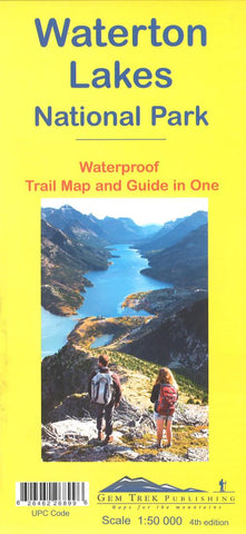
Waterton Lakes National Park, Alberta and British Columbia Trail Map and Guide (waterproof) by Gem Trek
The Waterton Lakes National Park map is one of our most popular trail map-guides for the Canadian Rockies. This third edition is relief shaded and printed on waterproof material.
The map covers all of Waterton Lakes National Park, the eastern end of Akamina-Kishinena Provincial Park, and the Goat Haunt or northern area of Glacier National Park, Montana, at the south end of Upper Waterton Lake.
The front of the map covers all of the hiking and biking trails departing from Waterton town site, Red Rock Parkway, Akamina Parkway, and the Goat Haunt region of Glacier National Park. Popular trails covered include Carthew-Alderson, Crypt Lake, Goat Lake, Twin Lakes, Forum and Wall lakes, and the Tamarack Trail. Also on the front is an inset map (1:35,000) of Waterton town site, with accommodation and services marked for your convenience.
On the back of the map are trail descriptions of more than 20 of the best day hikes in the area, ranging from short interpretive walks to strenuous hikes up to alpine meadows. There are also trail descriptions of four classic bike-and-hike trails and seven overnight or multi-day trips. Included in each trail description are distance, elevation gain and highlights along the way. Twelve color photos accompany the text.
Also on the back is a list of recommended trails for waterfalls, views, rainy days, wildflowers and mountain bike rides, plus information on three scenic drives as well as Park contact information.
- Product Number: 2256219M
- Product Code: GEM_WATERTON
- ISBN: 9781895526899
- Year of Publication: 2017
- Folded Size: 10.24 x 4.72 inches
- Unfolded Size: 25.98 x 30.31 inches
- Map type: Folded Map
- Geographical region: Canada

