
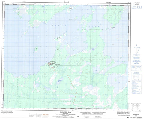
063G04 Napanee Bay Canada topo map, 1:50,000 scale
063G04 Napanee Bay NRCAN topographic map.
Includes UTM and GPS geographic coordinates (latitude and longitude). This 50k scale map is suitable for hiking, camping, and exploring, or you could frame it as a wall map.
Printed on-demand using high resolution, on heavy weight and acid free paper, or as an upgrade on a variety of synthetic materials.
Topos available on paper, Waterproof, Poly, or Tyvek. Usually shipping rolled, unless combined with other folded maps in one order.
- Product Number: NRCAN-063G04
- Parent Topo: TOPO-063G
- Map ID also known as: 063G04, 63G4, 63G04
- Unfolded Size: Approximately 26" high by 36" wide
- Weight (paper map): ca. 55 grams
- Map Type: POD NRCAN Topographic Map
- Map Scale: 1:50,000
- Geographical region: Manitoba, Canada
Neighboring Maps:
All neighboring Canadian topo maps are available for sale online at 1:50,000 scale.
Purchase the smaller scale map covering this area: Topo-063G
Spatial coverage:
Topo map sheet 063G04 Napanee Bay covers the following places:
- Cranberry Bay - Cross Bay - Lamb Bay - Napanee Bay - Shallow Bay - Anchor Point - Kakakenowuchewun Point - Lookout Point - Rabbit Point - The Narrows - Chemawawin 2 - Calico Island - Centre Island - Channel Island - Charles Island - Collins Island - Dividing Island - Johnson Island - McKay Island - McMillan Island - Moose Island - Smith Island - Spruce Island - Willow Island - Cedar Lake - Kakakenowuchewun Lake - Muskeg Lake - Onuhupeewin Lake - Stable Lake - Demi-charge Rapids - Flying Post - Cross Bay Creek - Onuhupeewin Creek - Rivière Saskatchewan - Saskatchewan River - McKenzie Portage - Easterville


