
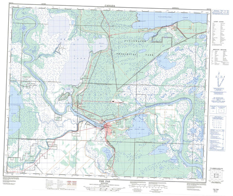
063F14 The Pas Canada topo map, 1:50,000 scale
063F14 The Pas NRCAN topographic map.
Includes UTM and GPS geographic coordinates (latitude and longitude). This 50k scale map is suitable for hiking, camping, and exploring, or you could frame it as a wall map.
Printed on-demand using high resolution, on heavy weight and acid free paper, or as an upgrade on a variety of synthetic materials.
Topos available on paper, Waterproof, Poly, or Tyvek. Usually shipping rolled, unless combined with other folded maps in one order.
- Product Number: NRCAN-063F14
- Parent Topo: TOPO-063F
- Map ID also known as: 063F14, 63F14
- Unfolded Size: Approximately 26" high by 36" wide
- Weight (paper map): ca. 55 grams
- Map Type: POD NRCAN Topographic Map
- Map Scale: 1:50,000
- Geographical region: Manitoba, Canada
Neighboring Maps:
All neighboring Canadian topo maps are available for sale online at 1:50,000 scale.
Purchase the smaller scale map covering this area: Topo-063F
Spatial coverage:
Topo map sheet 063F14 The Pas covers the following places:
- Campers Cove - Watchi Bay - Sunset Beach - Pumphouse Point - Rocky Point - Big Eddy Settlement - Pasquia Settlement - Opaskwayak Cree Nation 21A - Opaskwayak Cree Nation 21B - Opaskwayak Cree Nation 21C - Opaskwayak Cree Nation 21D - Opaskwayak Cree Nation 21E - Opaskwayak Cree Nation 21F - Opaskwayak Cree Nation 21G - Opaskwayak Cree Nation 21I - Opaskwayak Cree Nation 21J - Opaskwayak Cree Nation 21K - Opaskwayak Cree Nation 21N - Opaskwayak Cree Nation 21P - Opaskwayak Cree Nation Root Lake 231 - Réserve indienne Root Lake 231 - Réserve indienne The Pas 21A - Réserve indienne The Pas 21B - Réserve indienne The Pas 21C - Réserve indienne The Pas 21D - Réserve indienne The Pas 21E - Réserve indienne The Pas 21F - Réserve indienne The Pas 21G - Réserve indienne The Pas 21I - Réserve indienne The Pas 21J - Réserve indienne The Pas 21K - Réserve indienne The Pas 21N - Réserve indienne The Pas 21P - Root Lake Indian Reserve 231 - The Pas Indian Reserve 21A - The Pas Indian Reserve 21B - The Pas Indian Reserve 21C - The Pas Indian Reserve 21D - The Pas Indian Reserve 21E - The Pas Indian Reserve 21F - The Pas Indian Reserve 21G - The Pas Indian Reserve 21I - The Pas Indian Reserve 21J - The Pas Indian Reserve 21K - The Pas Indian Reserve 21N - The Pas Indian Reserve 21P - Bucks Island - Dunlop Island - Fisher Island - Kaministikwatinak Island - Kaministikwatinask Island - Kanayapiskak Island - Middle Island - Ochayk Island - Poplar Island - Potato Island - Rahls Island - Ralls Island - Round Island - Atikameg Lake - Campbell Lake - Cedar Pond - Cemetery Lake - Clearwater (Atikameg) Lake - Clearwater Lake - Grace Lake - Halcrow Lake - Kakeyskachak Lake - Kamasikomak Lake - Kanaabiskack Lake - Kanayapiskak Lake - Kapiskeetaw Lake - Little Minekwao Lake - Mistasinnewuk Lake - Mistikewapi Lake - Montreal Lake - Muskitapan Lake - Pike Lake - Pine Pond - Reader Lake - Saskeram Lake - Shallow Lake - Simon Lake - Spruce Pond - The Pas Lake - Wanastikwayak Lake - Kelsey - Clearwater Lake Provincial Park - Saskeram Wildlife Management Area - Tom Lamb Wildlife Management Area - Birch River - Carrot River - Dinner Place Creek - Jackfish Creek - Kapakoneecheewak Creek - Middle Cut-off - Muskitapan Creek - Pasquia River - Rahls Creek - Ralls Creek - Reader Creek - Red Rock Creek - Rivière Saskatchewan - Saskatchewan River - Saskeram River - Summerberry River - Whitefish River - Wuskay Creek - Omaneesis Portage - Papimpataw Portage - The Pas - Clearwater Sanatorium - Flin Flon Junction - Grace Lake - Guy Hill - Moostissoostikwan - Orok - Prospector - Rahls Island - Ralls Island - The Pas Airport - Tremaudan - Umpherville - Young Point


