
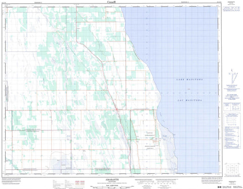
062J10 Amaranth Canada topo map, 1:50,000 scale
062J10 Amaranth NRCAN topographic map.
Includes UTM and GPS geographic coordinates (latitude and longitude). This 50k scale map is suitable for hiking, camping, and exploring, or you could frame it as a wall map.
Printed on-demand using high resolution, on heavy weight and acid free paper, or as an upgrade on a variety of synthetic materials.
Topos available on paper, Waterproof, Poly, or Tyvek. Usually shipping rolled, unless combined with other folded maps in one order.
- Product Number: NRCAN-062J10
- Parent Topo: TOPO-062J
- Map ID also known as: 062J10, 62J10
- Unfolded Size: Approximately 26" high by 36" wide
- Weight (paper map): ca. 55 grams
- Map Type: POD NRCAN Topographic Map
- Map Scale: 1:50,000
- Geographical region: Manitoba, Canada
Neighboring Maps:
All neighboring Canadian topo maps are available for sale online at 1:50,000 scale.
Purchase the smaller scale map covering this area: Topo-062J
Spatial coverage:
Topo map sheet 062J10 Amaranth covers the following places:
- Sandy Bay - Sandy Point - Alonsa Drain - Riding Mountain Drain - Rocklan Drain - Sandy Bay 5 - Big Stump Lake - Cutbank Lake - Jackfish Lake - Lac Manitoba - Lake Manitoba - Little Long Lake - Robertson Lake - Alonsa - Glenella - Lakeview - Westbourne - Amaranth Beach Provincial Recreation Park - Big Grass Marsh Game Bird Refuge - Big Grass River - Garrioch Creek - Amaranth - Baffin - Beckville - Embury - Grass River - Harcus - Leifur - Little Ridge - Lone Spruce - Marius - Sandy Bay - Big Grass Marsh - Big Meadow


