
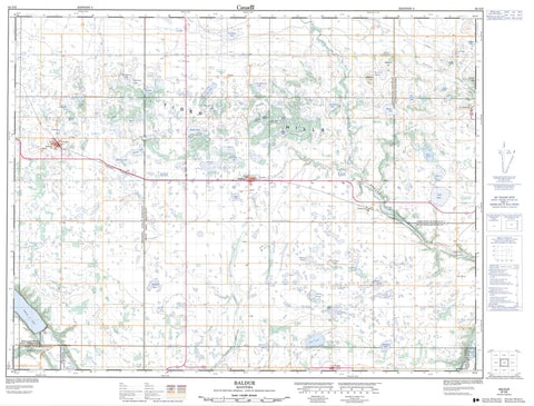
062G06 Baldur Canada topo map, 1:50,000 scale
062G06 Baldur NRCAN topographic map.
Includes UTM and GPS geographic coordinates (latitude and longitude). This 50k scale map is suitable for hiking, camping, and exploring, or you could frame it as a wall map.
Printed on-demand using high resolution, on heavy weight and acid free paper, or as an upgrade on a variety of synthetic materials.
Topos available on paper, Waterproof, Poly, or Tyvek. Usually shipping rolled, unless combined with other folded maps in one order.
- Product Number: NRCAN-062G06
- Parent Topo: TOPO-062G
- Map ID also known as: 062G06, 62G6, 62G06
- Unfolded Size: Approximately 26" high by 36" wide
- Weight (paper map): ca. 55 grams
- Map Type: POD NRCAN Topographic Map
- Map Scale: 1:50,000
- Geographical region: Manitoba, Canada
Neighboring Maps:
All neighboring Canadian topo maps are available for sale online at 1:50,000 scale.
Purchase the smaller scale map covering this area: Topo-062G
Spatial coverage:
Topo map sheet 062G06 Baldur covers the following places:
- Kiwanis Beach - Pelican Lake Inlet Channel - Pelican Lake Outlet Control Structure - Pembina River Diversion - Waldon Control Structure - Bellows Lake - Bennonys Lake - Bjornson Lake - Bottomless Lake - Breaults Lake - Christopherson Lake - Cobbes Lake - Cubbeys Lake - Doigs Lake - Fisher Lake - Gerolamy Lake - Gibsons Lake - Godard Lakes - Goodbrands Lake - Goodmans Lake - Greenway Lake - Hoseas Lake - Jones Lake - Lake Nine - Long Lake - Lorne Lake - Lussier Lake - Markus Lake - McDonalds Lake - McLean Lake - McLeods Lake - Morin Lake - Pelican Lake - Prospect Lake - Round Lake - Saltwater Lake - Springs Lake - Sveinsson Lake - Taylors Lake - Thorsteinsons Lake - Van Damme Lake - Van Der Walle Lake - Williamsons Lake - Willoughbys Lake - Wrays Lake - Wytincks Lake - Elodies Hill - Helgasons Hill - Tiger Hills - Wytincks Hill - Argyle - Lorne - Louise - Roblin - Strathcona - Tiger Hills Wildlife Management Area - Cypress River - Dry River - Marringhurst Creek - Oak Creek - Pelican Lake Outlet Channel - Pembina River - Pilot Creek - Rivière Pembina - Parks Route - Route des parcs - Baldur - Belmont - Cypress River - Dry River - Glenora - Greenway - Grund - Hartney Junction - Pleasant Valley - St. Alphonse - Greenway Valley - Kellys Ravine - Pembina Valley - Allards Slough - Ballantynes Marsh - Bardarson Slough - Brinkworth Slough - Chalmers Slough - Combers Slough - Cropley Slough - De Smets Slough - Excelsior Slough - Levreaults Slough - Martins Slough - Sigurdson Slough - Tisdales Slough - Williamsons Marsh - Woods Slough


