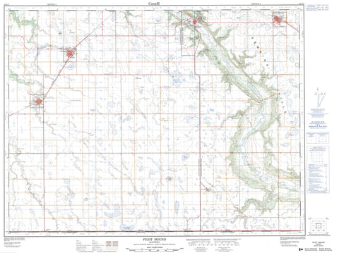
062G02 Pilot Mound Canada topo map, 1:50,000 scale
062G02 Pilot Mound NRCAN topographic map.
Includes UTM and GPS geographic coordinates (latitude and longitude). This 50k scale map is suitable for hiking, camping, and exploring, or you could frame it as a wall map.
Printed on-demand using high resolution, on heavy weight and acid free paper, or as an upgrade on a variety of synthetic materials.
Topos available on paper, Waterproof, Poly, or Tyvek. Usually shipping rolled, unless combined with other folded maps in one order.
- Product Number: NRCAN-062G02
- Parent Topo: TOPO-062G
- Map ID also known as: 062G02, 62G2, 62G02
- Unfolded Size: Approximately 26" high by 36" wide
- Weight (paper map): ca. 55 grams
- Map Type: POD NRCAN Topographic Map
- Map Scale: 1:50,000
- Geographical region: Manitoba, Canada
Neighboring Maps:
All neighboring Canadian topo maps are available for sale online at 1:50,000 scale.
Purchase the smaller scale map covering this area: Topo-062G
Spatial coverage:
Topo map sheet 062G02 Pilot Mound covers the following places:
- Rinns Point - Smiths Point - Crystal City Dam - McDonald Drain - Pilot Mound Dam - Star Mound - Crystal City Reservoir - Falcon Pond - Goudney Reservoir - Hudson Bay Lake - Morrows Lake - Boltons Hill - Eagle Hill - Mount Royal - Nebogwawin Butte - Old Dicks Lookout - Pembina Hills - Pilot Mound - Shale Hill - Suicide Hill - Terrys Hill - Louise - Pembina - Cranes Creek - Crystal Creek - Cypress Creek - Long River - Mary Jane Creek - McCoys Creek - Pembina River - Pilot Creek - Rivière Pembina - Snowflake Creek - Stony Creek - Boundary Commission - N.W.M.P. Route - Conners Bridge - Maurice Ridley Bridge - Smiths Bridge - Pilot Mound - Fallison - Harbor - Hebb - La Rivière - Purves - Snowflake - Wood Bay - Eastwood Ravine - Fargeys Ravine - Pembina Valley - Wightmans Ravine - Woodlots Ravine - Armstrongs Slough - Bannisters Slough - Boatmans Slough - Bowlers Sloughs - Broughton Slough - Browns Slough - Dews Slough - Hendersons Slough - Kingstons Slough - McDonalds Slough - McKinnons Slough - Mogridge Slough - Monts Slough - Moores Slough - Phair Slough - Platts Slough - Pollocks Slough - Robinsons Slough - Stewart Slough - Wokes Slough - Wokes Sloughs - Crystal City - Manitou

