
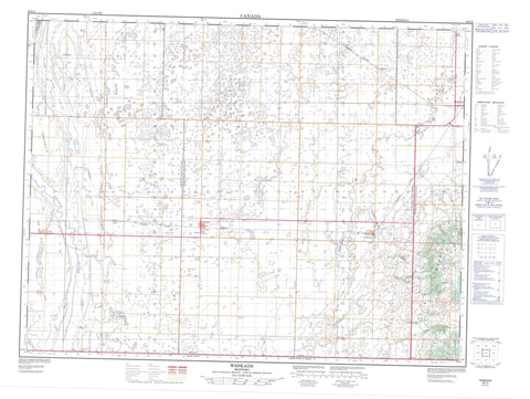
062F02 Waskada Canada topo map, 1:50,000 scale
062F02 Waskada NRCAN topographic map.
Includes UTM and GPS geographic coordinates (latitude and longitude). This 50k scale map is suitable for hiking, camping, and exploring, or you could frame it as a wall map.
Printed on-demand using high resolution, on heavy weight and acid free paper, or as an upgrade on a variety of synthetic materials.
Topos available on paper, Waterproof, Poly, or Tyvek. Usually shipping rolled, unless combined with other folded maps in one order.
- Product Number: NRCAN-062F02
- Parent Topo: TOPO-062F
- Map ID also known as: 062F02, 62F2, 62F02
- Unfolded Size: Approximately 26" high by 36" wide
- Weight (paper map): ca. 55 grams
- Map Type: POD NRCAN Topographic Map
- Map Scale: 1:50,000
- Geographical region: Manitoba, Canada
Neighboring Maps:
All neighboring Canadian topo maps are available for sale online at 1:50,000 scale.
Purchase the smaller scale map covering this area: Topo-062F
Spatial coverage:
Topo map sheet 062F02 Waskada covers the following places:
- The Peninsula - Blue Lake - Grumble Hill - Turtle Mountain - Arthur - Brenda - Winchester - Manitoba - Blind River - Boundary Creek - East Branch Medora Creek - Medora Creek - Medora Creek - Souris River - Waskada Creek - West Branch Medora Creek - Boundary Commission - N.W.M.P. Route - Hipkins Spring - Deloraine - Coulter - Cranmer - Dalny - Goodlands - Leighton - Blind River Valley - Ferguson Meadow - Goodlands Marsh - McKillop Meadow - Robinsons Slough - Temples Meadow - Temples Slough - Waskada


