
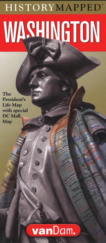
Washington Presidential Map
VanDams Washington Presidential Map is both a laminated street map to the Capital and a handy history chart of the life of our first President George Washington. The history map puts his personal geography into the context of his age. The street map covers all attractions including museums, monuments, tourbus stops and restrooms on on and around The Mall. Perfect for class trips where students can remember what they saw.
Contents: Washington DC Mall Map scale 1:9,500 Capital Region Map scale: 1:238,000 WDC Metro Transit Map
The Washington Presidential Map life map details his trajectory from British soldier, surveyor, land and slave owner, signer of the Declaration of Independence, commander in chief during the Revolution War, leader of the Constitutional convention, and First President of the new nation. A must-have for every history buff and visitor to the Washington Monument who wants to understand why we honor this man.
This special Capital Edition includes det
- Product Number: VD_P_WASH_CAP_20
- Reference Product Number: 2302664M
- ISBN: 9781934395974
- Date of Publication: 6/1/2019
- Folded Size: 9.06 inches high by 4.33 inches wide
- Unfolded (flat) Size: 31.89 inches high by 9.06 inches wide
- Map format: Folded
- Map type: Trade Maps - Historical
- Geographical region: United States
- Geographical subregion: District of Columbia


