
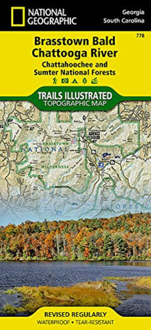
Chattahoochee and Sumter National Forests, GA/SC, Map 778
• Waterproof • Tear-Resistant • Topographic Map
Located just north of Atlanta, the Chattahoochee National Forest contains the southern terminus of the Appalachian Trail along with an abundance of recreational opportunities for outdoor enthusiasts of all interests.
This recreation map contains carefully researched trails, campsites, forest service roads, and points-of-interests.
Useful UTM and Latitude/Longitude grids, mileage charts, and other navigation features make Brasstown Bald/Chattooga River the best map available for this section of the Chattahoochee National Forest.
The West Side of the Map Includes: Chatuge Lake, Lake Burton, Brasstown National Wilderness, Chattahoochee Wildlife Management Area, Raven Cliffs Wilderness, Blood Mountain Wilderness, Cooper Creek Wildlife Management Area, Anna Ruby Falls Scenic Area, Tray Mountain Wilderness, Swallow Creek Wildlife Management Area, Lake Burton Wildlife Management Area, Southern tip of the Nantahala Wil
- Product Number: TI_BRASSTOWN_20
- Reference Product Number: - None -
- ISBN: 9781566954679
- Date of Publication: 6/1/2020
- Folded Size: 9.45 inches high by 4.33 inches wide
- Unfolded (flat) Size: 24.8 inches high by 37.01 inches wide
- Map format: Folded
- Map type: Trade Maps - Park
- Geographical region: United States
- Geographical subregion: Georgia,South Carolina


