
Columbus : Cincinnati : regional map
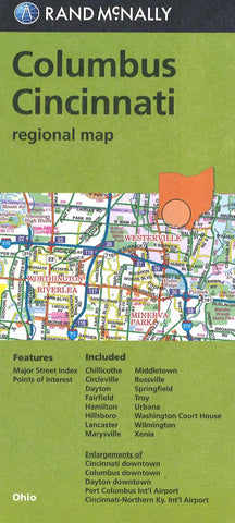
Rand McNallys folded map for Columbus Cincinnati is a must-have for anyone traveling in and around this part of Ohio, offering unbeatable accuracy and reliability at a great price. Trusted cartography shows all Interstate, U.S., state, and county highways, along with clearly indicated parks, points of interest, airports, county boundaries, and streets. The easy-to-use legend and detailed index make for quick and easy location of destinations. Youll see why Rand McNally folded maps have been the trusted standard for years.
Regularly updated
Full-color maps
Clearly labeled Interstate, U.S., state, and county highways
Indications of parks, points of interest, airports, county boundaries, downtown & vicinity maps
Major attractions & Golf Courses
Enlargements of Cincinnati downtown, Columbus downtown, Dayton downtown, Port Columbus Intl Airport, Cincinnati-Northern Ky. Intl Airport
Easy-to-use legend
Detailed index & Major Street Index
Convenient folded si
- Product Number: RM_CLMB_CIN_REG_19
- Reference Product Number: 2301850M
- ISBN: 9780528008917
- Date of Publication: 6/1/2019
- Folded Size: 9.06 inches high by 3.94 inches wide
- Unfolded (flat) Size: 39.37 inches high by 26.77 inches wide
- Map format: Folded
- Map type: Trade Maps - City Maps
- Geographical region: United States
- Geographical subregion: Ohio


