
1959 Southwestern United States Map
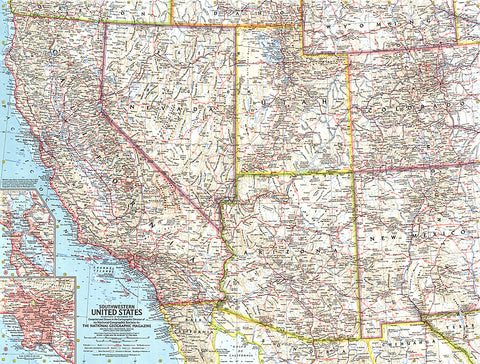
This map of the Southwestern United States features California, Nevada, Utah, Arizona, New Mexico, and Colorado. Includes detailed insets of the densely-populated San Francisco Bay and Los Angeles metropolitan areas. Published in November 1959, it is part of a series of six sectional maps of the United States published between 1958 and 1961.
- Product Number: PODHNG_US_SW_59
- Reference Product Number: 2321208M
- ISBN: - None -
- Date of Publication: 6/1/1959
- Unfolded (flat) Size: 18.75 inches high by 24.75 inches wide
- Map format: Wall
- Map type: Trade Maps - Political
- Geographical region: United States


