
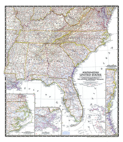
1947 Southeastern United States Map
The Southeastern United States map appeared in National Geographic Magazine in February 1947. Particular attention is paid to the Atlantic coastlines with insets of the South Carolina and Georgia coasts, and Cape Hatteras and Norfolk. It also features an inset of the lower Mississippi region including New Orleans.
- Product Number: PODHNG_US_SE_47
- Reference Product Number: 2321200M
- ISBN: - None -
- Date of Publication: 6/1/1947
- Unfolded (flat) Size: 31.25 inches high by 27.25 inches wide
- Map format: Wall
- Map type: Trade Maps - Political
- Geographical region: United States


