
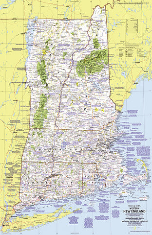
1975 Close-up USA, Western New England Map
This map lets you explore the Western New England region of the United States. Includes a wealth of travel and tourism information as well as an abundance of historical notes. Published in July 1975 as part of the Close-up: U.S.A. series, with an article on Cape Cod and the travel poster New Hampshire, Vermont, Massachusetts, Rhode Island, Connecticut: Mountains, Seacoast, and a Living Legacy.
- Product Number: PODHNG_US_N_ENG_W_75
- Reference Product Number: 2321219M
- ISBN: - None -
- Date of Publication: 6/1/1975
- Unfolded (flat) Size: 35 inches high by 22.75 inches wide
- Map format: Wall
- Map type: Trade Maps - Wall Art
- Geographical region: United States


