
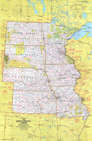
1974 Close-up USA, North Central States Map
This map of the North Central United States lets you explore the nation's heartland. Features a wealth of travel and tourism information, including national and state parks, festivals, events, and historic points of interest, as well as an abundance of historical notes. Published in March 1974 as part of the Close-up: U.S.A. series, with the travel poster North Dakota, South Dakota, Nebraska, Kansas, Minnesota, Iowa, Missouri: Open Skies and Rolling Land.
- Product Number: PODHNG_US_N_C_74
- Reference Product Number: 2321215M
- ISBN: - None -
- Date of Publication: 6/1/1974
- Unfolded (flat) Size: 35 inches high by 22.75 inches wide
- Map format: Wall
- Map type: Trade Maps - Wall Art
- Geographical region: United States


